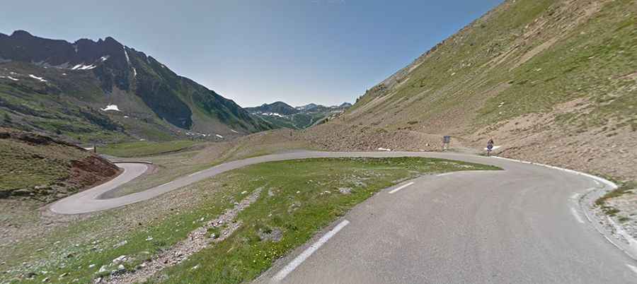
A curvy road with 75 hairpin turns to Col de la Lombarde
Col de la Lombarde-Colle della Lombarda is an international high mountain pass at an elevation of 2.354m (7,723ft) above sea level, located on the border of Italy and France.
Where is Col de la Lombarde-Colle della Lombarda?
The pass links the Alpes-Maritimes department in southeastern France and the Province of Cuneo in the Italian region of Piedmont.
Is the road to Col de la Lombarde-Colle della Lombarda paved?
Set high above the ski resort of Isola 2000, in the Alps, the winding and curvy road to the summit is totally paved and extremely defiant, with 75 sharp hairpin turns. It’s called M97 in France and Strada Provinciale 255 (SP255) in Italy.
Is the road to Col de la Lombarde-Colle della Lombarda open?
The pass, completed in 1971, is usually open only throughout the summer to vehicles.
How long does it take to drive Col de la Lombarde-Colle della Lombarda?
To drive the road without stopping will take most people between 1 and 1.5 hours. The drive features stunning views. There are many military vestiges of WW2 (blockhouses and barracks) near the top. At the summit is a small parking lot.
How long is Col de la Lombarde-Colle della Lombarda?
The pass is 41.6 km (25.84 miles) long, running south-north from Isola (in France) to Vinadio (in Italy). The Tour de France crossed this pass for the first time in 2008. The road has very steep sections, hitting a 17% maximum gradient through some of the ramps.