The Challenging Road to Pian del Re in the Cottian Alps
Pian del Re is a high mountain plateau at an elevation of 2,020m (6,627ft) above sea level, located in the Province of Cuneo, in Italy.
Where is Pian del Re?
The plateau is located in the Piedmont region, in the northern part of the country, within Valle Po. At the summit, there’s a large parking lot, a mountain refuge, and a few buildings. The Rifugio Albergo is still today the best starting point for numerous trips and stop along the most famous Giro del Monviso.
Why is it called Pian del Re?
It seems the name of the plateau comes from the time when the French army was there during the reign of Francis I of France, before the invasion of the Duchy of Savoy.
How long is the road to Pian del Re?
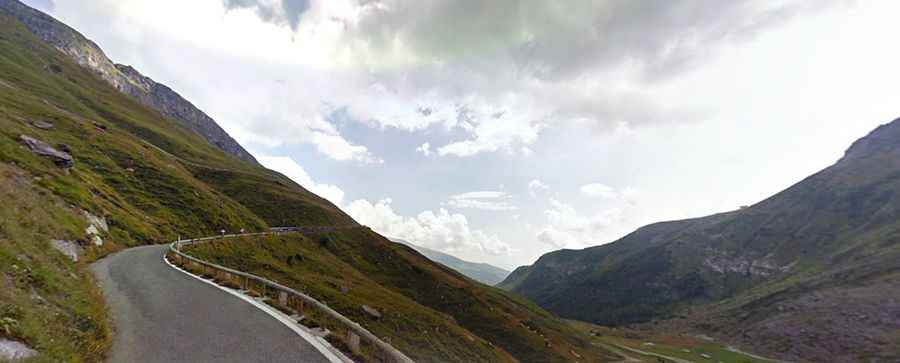
The road to the plateau is fully paved. It’s 11 km (6.83 miles) long, starting from Crissolo. Over this distance, the elevation gain is 878 m. The average gradient is 7.98%.
How challenging is the road to Pian del Re?
The road to the plateau is called Strada Provinciale 234. The asphalt is in good condition throughout the entire climb. The width varies—wider between Crissolo and Paesana, and very narrow in the final 3 km from Pian della Regina to Pian del Re. With little traffic, the road is forbidden to trucks, and the average gradient is 7.5%.
Is the road to Pian del Re open in winter?
Set high in the Cottian Alps, chains or snow tires may be required throughout the year. This road is only open between June and October.