The climb to Monte Zoncolan is even harder than it sounds
Monte Zoncolan is a high mountain pass at an elevation of 1.732m (5,682ft) above sea level, located in the province of Udine in Italy. This savage mountain pass hits a 23% of maximum gradient.
Where is Monte Zoncolan?
The pass is located in the autonomous region Friuli-Venezia Giulia, in the northwestern part of the country, near the Austrian border.
Is Monte Zoncolan paved?
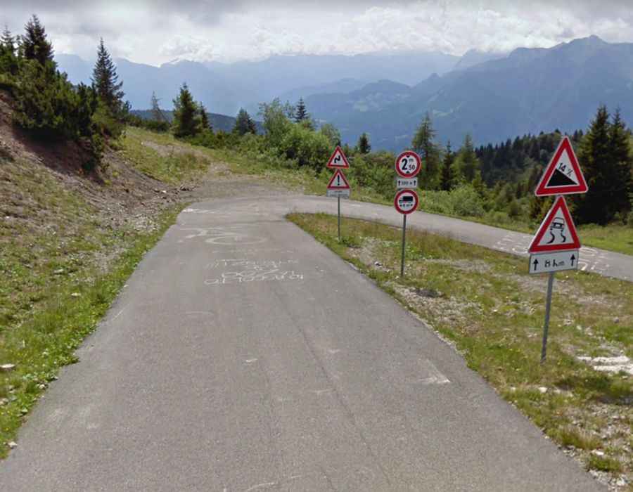
Set high in the Carnic Alps, the narrow road to the iconic pass, known as the King of the Carnic Alps, is totally paved. It’s called Strada Provinciale 123 (SP123).
How long is Monte Zoncolan?
The pass is 23.6 km (14.66 miles) long, running west-east from Ovaro to Sutrio. The former rough asphalt was replaced in 2005.
How long does it take to drive Monte Zoncolan?
To drive the road without stopping will take most people between 45 and 60 minutes. The summit hosts a parking lot and a statue: Monument to the cyclist climber.
How hard is Monte Zoncolan?
It’s one of the most demanding and difficult climbs in professional road bicycle racing, featured in the Giro d'Italia many times. The road is brutal. It hits a 23% of maximum gradient through some of the ramps and has three short tunnels and 38 hairpin turns. It has been compared with Angliru, the fearsome climb in the Spanish region of Asturias. The steepest, 23.5-percent pitch of the Angliru is very short however, being part of a kilometer stretch that averages "only" 17.2 percent. While the Zoncolan has a kilometer of nearly 20%.