Col du Clapier is where Hannibal crossed the Alps
Col du Clapier-Colle Clapier is an international high mountain pass at an elevation of 2.480m (8,170ft) above sea level, straddling the Italian-French border.
Where is Col du Clapier-Colle Clapier?
Set high in the northern Cottian Alps, this pass connects the Savoie department in the Auvergne-Rhône-Alpes region of south-eastern France with the Piedmont region in Italy.
Can I drive to Col du Clapier-Colle Clapier?
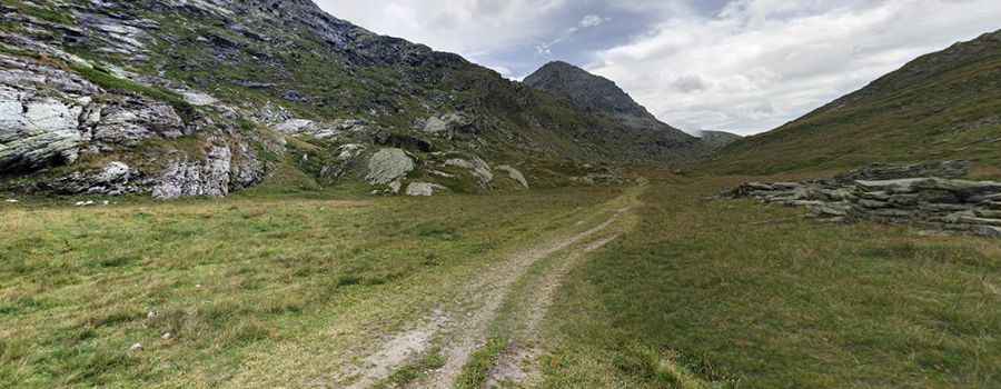
Also known as Col de la Savine, this pass is traversed by a bridle path extending from Bramans (1,220 m) to Susa (503 m). It doesn't have a paved road, and access is restricted from September to June due to snow. Starting from Col du Petit Mont Cenis, the ascent to the summit is 7.0 km (4.34 miles) long. The initial segments are part of a military road, accessible to 4x4 vehicles and bikes. This gravel road is an old military route, with the French/Italian alpine border boasting numerous high-altitude military roads from the late 1800s and especially from WW1. The final stretch beyond Lac de Savine is impassable to vehicles, though bikes can traverse it. On the Italian side, it remains a mule track exclusively for pedestrians.
Where did Hannibal crossed the Alps?
This pass is believed to be one of the potential routes Hannibal took during his renowned crossing of the Alps in 218 BC. Historians have debated for over two millennia about the exact pass Hannibal used when he led his army, consisting of 50,000 men, 5,000 horses, and 37 elephants, through the Alps from the Rhone river valley into Italy. His aim was to bring the battle directly to the Roman Republic by bypassing Roman and allied land garrisons and evading Roman naval dominance. While Napoleon believed it was the Col du Mont Cenis (a claim the local tourist office agrees with), many posit it might have been the more secluded Col de Clapier. Other suggested routes include the Little St Bernard Pass, Col de la Traversette, and Col de Montgenèvre.
Pic: Bertrand Dujardin