How to drive the unpaved road to Col de Saurel in the Cottian Alps?
Col de Saurel is a high mountain pass at an elevation of 2,392 meters (7,847 ft) above sea level, located on the border between France and Italy, in the Cottian Alps.
| Road facts: Col de Saurel | |
|---|---|
| Location | Cottian Alps, France-Italy border |
| Elevation | 2,392 m (7,847 ft) |
| Length | 6.3 km (3.9 miles) from Sagna Longa |
| Average Gradient | 6.36% |
| Surface | Totally unpaved / Loose shale and rock fragments |
Is the road to Col de Saurel unpaved?
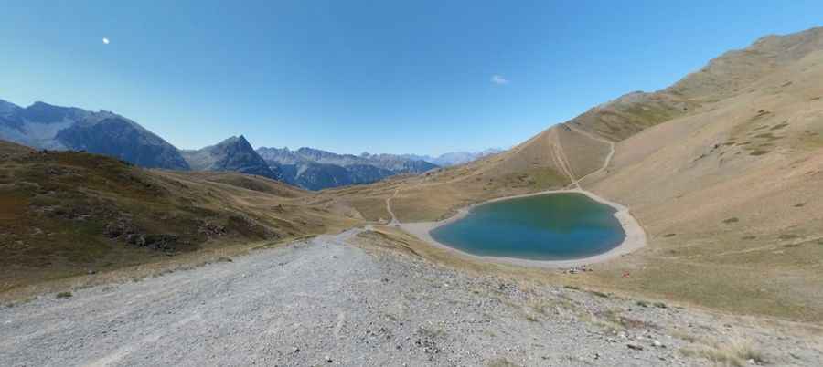
The unpaved route to the summit is a military track that connects the Sagna Longa sector with the Lago di Sette Colori (Lago dei Sette Colori) and the Capanna Mautino refuge lines.
How long is the road to Col de Saurel?
Starting from Sagna Longa, the road to the summit is 6.3 km long and the average gradient is 6.36%. A four-wheel-drive vehicle with high ground clearance is required. Sudden summer storms quickly turn the dry limestone dust into a sticky mud slurry.
Is the track to Col de Saurel too rough for a standard vehicle?
The road features loose gravel and rocky parts. Part of the old "Clavierissima" mountain circuit, the surface is heavily eroded by alpine snowmelt, leaving deep ruts and sharp, exposed limestone blocks. The blind corners are frequently shared with mountain bikes and local forestry vans.
Pic: Paolo Balzarotti