How to drive the unpaved road to Chaz-Dura?
Chaz-Dura is a high mountain peak at an elevation of 2.560m (8,398ft) above sea level, located in the autonomous region of Aosta Valley, in Italy. It's one of the highest roads in the country.
Where is Chaz-Dura?
The peak is located in the northern part of the country, within the Thuile Valley.
Is the road to Chaz-Dura unpaved?
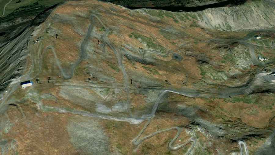
The road to the summit is totally unpaved. It’s a steep dirt road serves as a service route for the ski lifts and lodges of the La Thuile resort. 4x4 vehicles only.
How long is the road to Chaz-Dura?
Starting from Strada Statale 26 della Valle d'Aosta, the road to the summit is 6.4 km long. Over this distance, the elevation gain is 522 m and the average gradient is 8.15%.
Is the road to Chaz-Dura open year-round?
Set high in the Rutor Massif of the Graian Alps, the road is totally impassable in winters.