How to drive the steep road to Rifugio Pizzini in Lombardy
Rifugio Pizzini-Frattola is a high mountain hut at an elevation of 2,706m (8,877ft) above sea level, located in the Lombardy region of Italy. It is one of the highest roads in Italy.
Where is Rifugio Pizzini located?
The refuge is situated in the Province of Sondrio, within the Stelvio National Park, at the head of the Cedec Valley. It lies at the base of the Gran Zebrù (Königsspitze) and Cevedale peaks.
Why is there a road to the summit of Pizzini?
The road was built to serve the refuge, which is a major hub for mountaineers and hikers in the Alps. The original structure, Capanna Cedeh, was built in 1887 but was destroyed during the Great War, as this area was part of the high-altitude front.
Is a 4x4 required to drive to Rifugio Pizzini?
Motorized transit is strictly restricted to authorized staff and shuttle services due to environmental regulations. For the authorized vehicles, a high-clearance 4x4 vehicle is required.
How long is the road to Rifugio Pizzini?
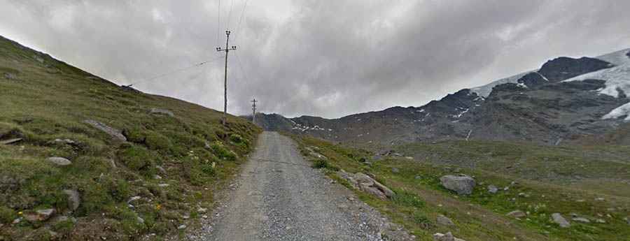
Starting from the nearby Rifugio Forni, the road gains 520 meters of elevation in just 4.4 kilometers, with an average gradient of 11.81%. Beyond the hut, a 4x4 trail continues climbing to Laghi di Cedèc, reaching an elevation of 2,833m (9,294ft) above sea level.
Is the road to Rifugio Pizzini unpaved?
The road is entirely unpaved with loose glacial gravel, scree, and large rocks. It is narrow and follows a ledge with steep, unprotected drops and no safety barriers. Meeting hikers or mountain bikers is common.
Is the road to Rifugio Pizzini open in winter?
The road is completely buried under deep snow and ice from late September until mid-June.