How to drive the rugged track to Col dei Pass in Belluno
Col dei Pass is a high mountain peak at an elevation of 1,818m (5,964ft) above sea level in the Province of Belluno, Italy.
Where is Col dei Pass?
The mountain is located in the northern part of the country, near the iconic Passo Duran. It hosts a mountain refuge known as Rifugio Bruto Carestiato.
Why is there a road to the summit of Col dei Pass?
The road was built specifically as a supply line for the refuge. Before 1978, the refuge was only accessible by mule track. Today, the road allows the transport of food, fuel, and materials necessary for the refuge.
Is the road to the summit of Col dei Pass unpaved?
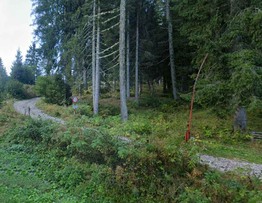
The road is totally unpaved made of loose dolomitic debris and rocky outcrops. It is very narrow and follows a ledge with sharp hairpins and unprotected drops.
How long is the road to Col dei Pass?
The road to the summit is 3.4km long starting from Passo Duran. While the average gradient is 8.6%, several ramps are significantly steeper. Due to its location, in a protected alpine environment, the track is strictly closed to private motorized traffic; only authorized staff and emergency services can drive here. For those with authorization, a high-clearance 4x4 is required.
Is the road to Col dei Pass open in winter?
Set high in the Moiazza massif, the road is completely buried under snow from late October until June and is impassable for any vehicle. During the winter season, the refuge is usually closed or only accessible on foot or by snowmobile for maintenance. Even in summer, the road can be affected by rockfalls.