Driving the high-altitude military road from Monte Saccarello to Colle del Garezzo
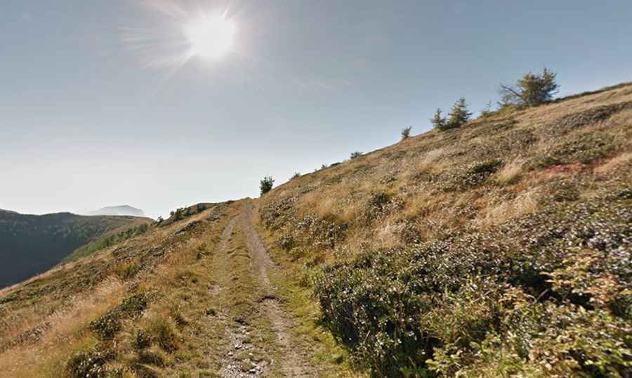
The high-altitude track running from Monte Saccarello to Colle del Garezzo is one of the most technical and spectacular military routes in the Ligurian Alps, in the Province of Imperia. This 6.8 km (4.2 miles) unpaved ridge road stays almost entirely above 2,000 meters, crossing several high mountain passes including Sella della Valletta, Passo di Garlenda, Punta di Santa Maria, and Passo Frontè. It is a route that tests the limits of any off-road vehicle and the nerves of the driver.
| Road facts: Monte Saccarello to Colle del Garezzo | |
|---|---|
| Location | Imperia, Liguria (Italy) |
| Length | 6.8 km (4.2 miles) |
| Max Elevation | 2,138 m (Punta di Santa Maria) |
| Surface | Loose rock, unpaved military track |
| Hazard Level | Extreme (Narrow, steep, unprotected) |
Is the road from Monte Saccarello to Colle del Garezzo driveable?
Running west to east, this military road connects the iconic Monte Saccarello with the Colle del Garezzo. While at first glance the terrain looks impassable for anything other than a mountain bike, evidence from the ground—including local 4x4s parked at high-altitude shelters like Rifugio Sanremo—confirms it is a viable, though extreme, driving route. The track follows the watershed line, often balancing on a narrow ledge with dizzying drops on both sides. Due to its strategic military history, the road was built to move heavy equipment, but decades of erosion have turned it into a "rock-crawling" challenge where 4x4 and high ground clearance are mandatory.
What mountain passes are on the Saccarello-Garezzo military route?
The 6.8 km journey is a continuous sequence of high summits and depressions. Starting from the west, the track first hits Punta di Santa Maria (2,138m) and the Sella della Valletta (2,054m). As you drive east, you traverse the Passo di Garlenda (2,019m) and finally Passo Frontè (2,094m). Every meter of this drive is on loose limestone and shale. The hairpins near Passo Frontè are particularly tight, forcing drivers to execute multi-point turns on unstable ground. The track is often used by authorized park rangers and local mountain hut keepers, and its accessibility for general tourists is frequently restricted to certain days or requires special permission.
What are the main hazards of this Ligurian ridge road?
The primary danger is the combination of extreme altitude and road surface degradation. The "pavement" consists of sharp rocks that can easily slash a sidewall. There are no guardrails, and in many sections, the track is barely wider than a standard Land Rover Defender. If you encounter another vehicle or even a group of mountain bikers, reversing on these ledges is a high-stakes maneuver. The weather is another critical factor; the "Maia" (sea fog) can roll in from the Mediterranean in minutes, reducing visibility to zero on a path where one wrong move means a 500-meter fall into the valley below.
When is the best time to drive the Passo Frontè track?
Due to its elevation staying consistently above 2,000 meters, this road is buried under snow for most of the year. It is usually only passable from late June to September. Even in mid-summer, the track can be blocked by late-season snowdrifts in the shaded northern faces near Passo di Garlenda. Mechanical preparation is vital: your cooling system will be stressed by the slow, high-torque climb, and your brakes will face a brutal descent back toward the coast. Always carry a full-size spare and recovery gear, as help in this remote sector of the Imperia mountains can be hours away.