Strada Provinciale 64 (SP64) is the road that has it all in the Veneto
Strada Provinciale 64 (SP64) is a highly challenging mountain road located in the province of Vicenza, Italy. This road offers jaw-dropping views, unparalleled freedom, and lots of fresh air.
Where is Strada Provinciale 64 (SP64)?
Situated in the Veneto Region, in the north-eastern part of Italy, the road was formerly known as Strada Provinciale 83 (SP83).
How long is Strada Provinciale 64 (SP64)?
The road is 34.9 km (21.68 miles) long, running south-north from Arsiero to the border of the Autonomous Province of Trento, near Villaggio Fiorentini. Plan about 35-40 minutes to complete the drive.
How challenging is Strada Provinciale 64 (SP64)?
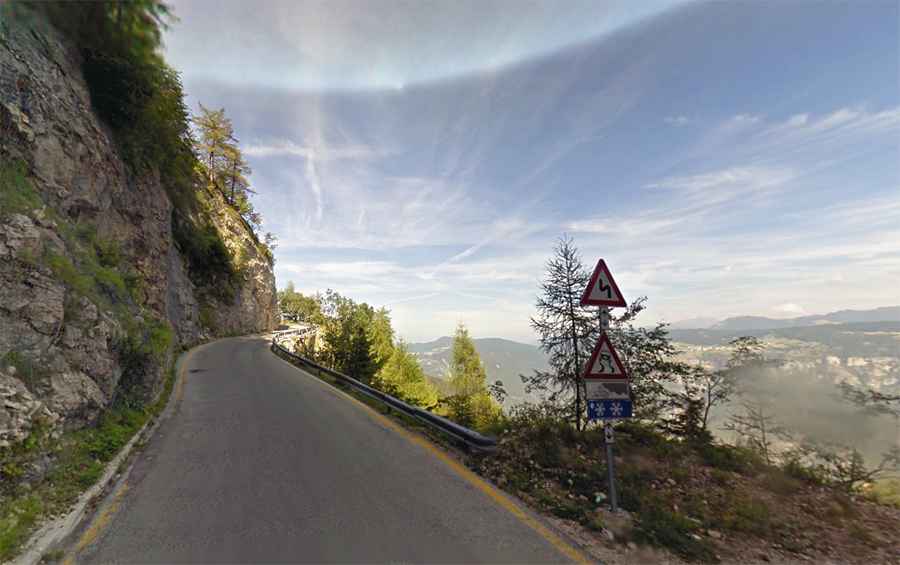
While the road is entirely paved, it is not easy at all. It encompasses a bit of everything: tunnels, drop-offs, turns, and hairpin turns, with narrow sections and steep areas, reaching a brutal 36.3% maximum gradient through some ramps. The road can be closed anytime due to the high risk of rock slides. Larger vehicles are prohibited and cannot access the road.
Is Strada Provinciale 64 (SP64) open?
Nestled in the Venetian Prealps, a mountain range in the southeastern part of the Alps, the road reaches an elevation of 1,512m (4,960ft) above sea level by the Altopiano dei Fiorentini, a mountain plateau near Passo della Vena. A small mountain chapel, Chiesetta di San Giovanni Gualberto, is located at the summit. It remains open year-round, but short-term closures are common in winter due to dangerous weather conditions caused by snow or ice.