What are the 5 Most Famous Scenic Roads in Italy?
Italy’s road network includes some of the most technically demanding routes in southern Europe. Navigating these sectors requires specific planning regarding vehicle dimensions, braking endurance, and traffic management. From the high-altitude alpine passes of the north to the narrow coastal shelves of the south, these Italian roads represent significant logistical challenges for any driver.
| Driving Logistics: Major Italian Routes | |
|---|---|
| Stelvio Pass Max Elevation | 2,757 m (9,045 ft) |
| Amalfi Coast Width | Restricted / Single-lane sections |
| Surface Conditions | Paved (Asphalt / Cobblestones) |
| Winter Status | Passes closed Nov-May |
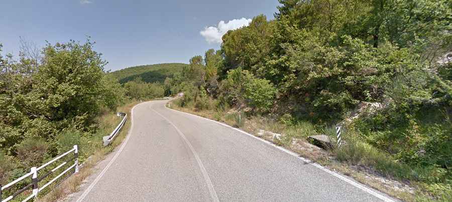
How to drive the SR222 Via Chiantigiana?
The Via Chiantigiana (SR222) is a 69-kilometer paved route connecting Florence and Siena. Technically, it is a narrow, winding road that traverses the Chianti wine region. Driving this route requires constant gear shifting due to the rolling topography and frequent tight curves. Heavy vehicles and wide motorhomes should be cautious, as the road lacks hard shoulders and features several sections with limited lateral clearance. During the harvest season, be alert for slow-moving agricultural machinery entering the main carriageway from unpaved vineyard tracks.
What are the technical challenges of the Stelvio Pass?
The Stelvio Pass (Passo dello Stelvio) is one of the highest paved roads in the Alps, reaching 2,757 meters. The northern ascent features 48 numbered hairpin turns (tornanti), while the southern side has 39. Logistically, this road is a high-stress environment for braking systems and engines. The turns are extremely tight, often requiring the full width of the road for larger vehicles to maneuver. Engine cooling must be in optimal condition for the sustained climb, and winter tires or chains are mandatory as snow can fall even during the summer months.
Is the Amalfi Coast Road safe for large vehicles?
The Amalfi Coast Road (SS163) is a 50-kilometer stretch between Sorrento and Salerno. It is built directly into the limestone cliffs, making it one of the most restricted roads in Italy. Traffic management is critical here, with strict regulations for buses and heavy vehicles during peak hours. The primary hazards are the narrow road width and the heavy congestion. Drivers must be prepared for mirror-to-mirror passages with oncoming traffic and frequent stops to allow buses to navigate the tightest corners. Engine braking is essential during the steep descents toward the coastal villages.
What is the route of the Great Dolomite Road?
The Great Dolomite Road (Grande Strada delle Dolomiti) covers approximately 110 kilometers between Bolzano and Cortina d'Ampezzo. It traverses several high mountain passes, including Passo Pordoi and Passo Falzarego. The road is fully paved and engineered for high-altitude transit, but it features sustained gradients of up to 12%. Driving logistics involve managing significant elevation changes in short distances. In winter, the passes are subject to closure or mandatory use of winter equipment. The surface remains in good condition, but rockfall protection galleries are common and require attention to vertical clearance for high-tonnage vehicles.
What are the driving restrictions on the Via Aurelia?
The Via Aurelia (SS1) is a historic coastal highway along the Italian Riviera. While it has been largely superseded by the A10 motorway for through-traffic, the original sections remain a vital logistical link. Driving the Via Aurelia requires navigating numerous urban centers with strict speed limits and pedestrian zones. The road is paved but can be slippery when wet due to sea spray residue. Large vehicles should plan their stops carefully, as parking and technical assistance are limited in the narrow, old-fashioned coastal resorts that line the route.