SR251 is the Italian road of the tsunami
Strada Regionale 251 (SR-251) is a scenic road located on the boundary between Veneto and Friuli Venezia Giulia, in the northern part of Italy.
Is Strada Regionale 251 paved?
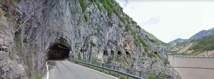
The road is totally paved with a few narrow parts. It features many tunnels. The longest tunnel is Galleria Fara (3.96km long).
How long is Strada Regionale 251?
It’s 52.7 km long, running west-east from Longarone (Province of Belluno) to Maniago (in the Province of Pordenone). The drive runs along the Vajont river and comprises stunning views of Vajont Dam, built between 1957 and 1960. Located in the valley of the Vajont River, the road tops out at Passo di Sant'Osvaldo, at 836m (2,742ft) above sea level.
Why is it called the road of the tsunami?
In 1963, Italy suffered the worst man-made environmental disaster in its history: a landslide caused a tsunami in the Vajont lake, in a wave of 250 metres, leading to the destruction of villages and towns, and killing almost 2,000 people. The crashing wall of water created an air pocket when it hit the ground, which was more powerful than the Hiroshima bomb.