What are the most spectacular roads in Italy?
In the heart of southern Europe, Italy stands tall as a country intricately woven with roads that are emblematic of its rich tapestry of history, unparalleled artistry, and nature's raw, untouched grandeur. To traverse Italy's roads is to embark upon an odyssey that tells tales from epochs gone by and teases with visions of scenic wonders.
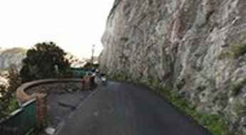
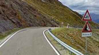
Start the journey with the iconic Stelvio Pass, a masterpiece of engineering often hailed as Europe's ultimate driving challenge. As your wheels glide through its countless turns, you're granted front-row seats to the theatre of the Alps, where snow-capped peaks converse with azure skies. Next, set course for the Amalfi Coast Road, a mesmerizing stretch where the Tyrrhenian Sea's sapphire waves play hide and seek with quaint coastal hamlets, reminiscent of postcard-perfect landscapes.
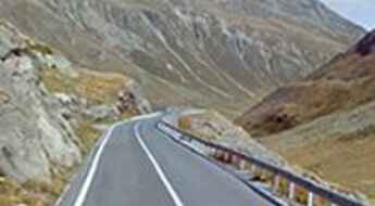
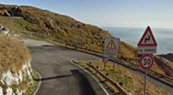
The Strada della Forra, with its cinematic allure, paints a canvas of dramatic gorges and tunnels, forever etched in memories by James Bond's escapades. The towering Gavia Pass, on the other hand, is a silent ode to the majesty of the Italian Alps. As if that isn't enough, the San Boldo Pass astonishes with its intricate dance of 18 hairpin bends and five tunnels, each narrating tales of human ingenuity. Then, in the midst of these giants, the Splügen Pass offers another layer of Alpine wonder, beckoning travelers with its mix of verdant landscapes and historical charm.
Every road in Italy is not just a means of commute; it's a passage through time, a trail of legends, and a gallery of Earth's masterpieces. And as you journey through these pathways, you are not just covering distances; you're collecting tales, imbibing culture, and weaving memories of a lifetime.
Navigating Forcella Luson: Italy's Hidden Gem in the Dolomites
Forcella Luson is a high mountain pass at an elevation of 2.383m (7,818ft) above the sea level, located in the Trentino-South Tyrol region of Italy.
The Road to Foscagno Pass: The Ultimate Alpine Driving Adventure
Passo di Foscagno is a high mountain pass at an elevation of 2,308m (7,572ft) above the sea level, located in the province of Sondrio, in the Lombardy region of Italy.
Mortirolo Pass: A Five-Star Road Through the Italian Alps
Situated at the crossroads of Brescia and Sondrio provinces in the Lombardy region of Italy, Passo di Mortirolo soars to an elevation of 1,878m (6,161ft) above the sea level. This legendary ascent stands as one of the most grueling challenges in professional cycling, having been featured repeatedly in the Giro d'Italia stage race.
Exploring Passo Tre Croci: A Scenic Road Through the Dolomites
Passo Tre Croci is a high mountain pass at an elevation of 1.811m (5,941ft) above the sea level, located in the Province of Belluno, in the Veneto region of Italy.
The winding road to Maniva Pass in the Alps and its 38 iconic hairpin turns
Passo del Maniva is a high mountain pass at an elevation of 1,664m (5,459ft) above sea the level. Located in the Brescia province of Lombardy, in Italy, this pass offers a picturesque drive through the Italian Alps.
Driving the curvy road to Serru Lake in the Alps
Lago Serrù is a high mountain reservoir at an elevation of 2.275m (7,464ft) above the sea level, located in the Province of Turin within the Piedmont region of Italy.
A challenging narrow road to Giogo della Bala in the Alps
Giogo della Bala is a high mountain pass, at an elevation of 2.129m (6,984ft) above the sea level located in the province of Brescia, in Lombardy.
An epic enthralling road to Monte Saccarello
Monte Saccarello-Mont Saccarel is an international high mountain peak at an elevation of 2.178m (7,145ft) above the sea level, located on the French-Italian border.
What you need to know about the 4x4 track to Forcella d’Entova
Forcella d’Entova is a high mountain pass at an elevation of 2.802m (9,192ft) above the sea level, located in the Province of Sondrio in the Italian region Lombardy. It's one of the highest roads of Europe.
The wild road to Testa Grigia in the Alps
Testa Grigia is an international high mountain peak at an elevation of 3.471m (11,387ft) above the sea level, located on the border of Switzerland and Italy. It’s one of the highest roads of Europe.
How to drive to Auronzo Refuge in the Dolomites?
Rifugio Auronzo is a high mountain refuge at an elevation of 2.340m (7,677ft) above the sea level, located on the boundary between the Trentino-South Tyrol and Veneto regions in Italy.
Monte Giovo Pass is a 5 stars road in the Italian Alps
Passo di Monte Giovo is a high mountain pass at an elevation of 2.094m (6,870ft) above the sea level, located in the South Tyrol province of Italy.
Via Provinciale Anacapri is a narrow coastal road on Capri
Via Provinciale Anacapri is a challenging coastal road situated on the island of Capri in the southern part of Italy.
A 5-star road to Forcola di Livigno Pass in the Alps
Livigno Pass-Forcola di Livigno Pass is an international high mountain pass at an elevation of 2,315m (7,595ft) above sea level, located on the border between Switzerland and Italy.
Cima Grappa is a classic road of Giro d'Italia
Cima Grappa is a high mountain pass at an elevation of 1,775m (5,769ft) above sea level, straddling the provinces of Treviso, Vicenza, and Belluno in the Veneto region of Italy. At the top sits the Sacrario Militare del Monte Grappa, a monumental burial site for soldiers killed on both sides of World War I.
Pennes Pass is a classic Italian road trip
Passo di Pennes is a high mountain pass at an elevation of 2,211m (7,254ft) above sea level, located in the Trentino-Alto Adige/Südtirol region of Italy.
Road trip guide: Conquering the Italian Via dei Saraceni
Via dei Saraceni is a road that has tested the nerves of numerous drivers, offering one of the most spectacular drives in Italy. Situated in the southwestern part of the Alps, this dirt track extends for over 20 km, reaching heights of over 2,000 meters above sea level, making it one of the highest roads in Europe, accessible exclusively for 4x4 vehicles.
How to travel Strada della Cucca to Pianella Pass?
Passo Pianella is a mountain pass at an elevation of 1,365m (4,478ft) above sea level located in the Veneto region of Italy.
Road trip guide: Conquering the paved San Marco Pass
Passo San Marco is a high mountain pass at an elevation of 1,985m (6,512ft) located on the boundary between Bergamo and Sondrio provinces in the Italian region of Lombardy.
The mule track to the top of Passo della Mulattiera
Passo della Mulattiera is a high mountain pass at an elevation of 2,412m (7,913ft) above sea level, located in the Province of Turin, in the Piedmont region of Italy.
A memorable road trip to Verva Pass in the Alps
Passo di Verva is a high mountain pass at an elevation of 2.301m (7,549ft) above sea level located in the Province of Sondrio, in the Lombardy region of Italy.
Falzarego Pass is a road with 38 sharp hairpin bends
Passo di Falzarego is a high mountain pass at an elevation of 2,105m (6,906ft) above the sea level, located in the province of Belluno, in the Veneto region of Italy.
Colle del Lago dei Signori: everything you need to know about this famed road
Colle del Lago dei Signori-Col de Seigneurs is an international high mountain pass at an elevation of 2,130m (6,988ft) above sea level, located on the border of Italy and France. The road traversing the pass was originally built for military purposes and was used during World War II.
The breathtaking road through Serrai di Sottoguda in the Dolomites
Located in the middle of the Dolomites, in the Italian Belluno province, part of the Veneto region, the road along the Serrai di Sottoguda gorge is one of the narrowest roads in the world. The Sottoguda gorge is closed to traffic; only pedestrians and cyclists are allowed.
Driving the unpaved military road to Colle del Mulo
Colle del Mulo is a high mountain peak, at an elevation of 2,523m (8,277ft) above sea level, located in the province of Cuneo, in the southwest of the Italian region of Piedmont.
A 5-star road to Manghen Pass in the Dolomites
Passo di Manghen is a high mountain pass at an elevation of 2,047m (6,716ft) above sea level, located in Trentino in the Italian region Trentino-Alto Adige/Südtirol. This is a tough climb from both the north and south.
Berga Pass: enjoy a road among the clouds in Italy
Passo della Berga is a high mountain pass at an elevation of 1.527m (5,009ft) above the sea level, located in the province of Brescia, in the Lombardy region of Italy. The pass is traversed by the spectacular Anfo ridge road.
Dosso Alto Pass: enjoy a road among the clouds
Passo del Dosso Alto is a high mountain pass at an elevation of 1.727m (5,666ft) above the sea level, located in the province of Brescia, in the Lombardy region of Italy. The pass is traversed by the spectacular Anfo ridge road.
The road to Lago di Teleccio: be ready to make room for oncoming vehicles
Lago di Teleccio is a high mountain artificial lake at an elevation of 1.918m (6,292ft) above the sea level, located in the Italian region Piedmont, within the Gran Paradiso National Park. It’s a mind numbing vertical drop of hundreds of meters so you might want to give it a miss on a windy day. The road is really steep, with sections up to 15.7% and 20 hairpin turns. It is narrow, so keep the speed down and be ready to move over and make room for oncoming vehicles.
Colla di Sanson is an old unpaved military road in the Ligurian Alps
Sanson Pass (also known as Colla di Sanson, Bassa di Sanson o Baisse de Sanson) is an international high mountain pass at an elevation of 1.694m (5,557ft) above the sea level, located in the Ligurian Alps, a mountain range on the border between France and Italy.
A narrow winding road to Sella Ciampigotto
Sella Ciampigotto is a high mountain pass at an elevation of 1.830m (6,003ft) above the sea level located in the province of Belluno, in the Italian region of Veneto
Monte Chaberton: Get behind the wheels for one of the planet’s most challenging trips
Strada militare dello Chaberton is an extreme high mountain track climbing up to the fort on top of French Mont Chaberton at an elevation of 3.131m (10,272ft) above the sea level. It's one of the highest mountain roads of Europe.
Colle della Boaria is a challenging drive in the Cottian Alps
Col de la Boaire (Colle della Boaria) is an international high mountain pass at an elevation of 2.102m (6,896ft) above the sea level, located in the Cottian Alps, between France and Italy, which links the Queyras valley (Hautes-Alpes) with Pontechianale in the province of Cuneo, Piedmont.
Ultimate 4wd destination: Laghi di Cedèc
Laghi di Cedèc is a high mountain lake at an elevation of 2.833m (9,294ft) above the sea level, located in the northern Italian province of Sondrio. It's one of the highest roads in Europe.
Muro di Guardiagrele is one of the Italian steepest roads
Muro di Guardiagrele is a vertical wall located in Guardiagrele, a town in the province of Chieti, part of the Abruzzo region of central Italy. This asphalted street is a climb that kicks up to 30 per cent gradient and is said to be the steepest street in the country.
A paved road to Sapienza Refuge in Mount Etna
Rifugio Sapienza is a high mountain refuge at an elevation of 1.935m (6,348ft) above the sea level, located in the Province of Catania in the Italian region Sicily, on the southern slope of Mount Etna.
