What are the most spectacular roads in Italy?
Located in the southern part of Europe, Italy is a dream for drivers as it hosts the mountain passes (the Alps), coastal drives (Adriatic, Ionian, Tyrrhenian, and Ligurian), and some of the most famous scenic routes in the world.
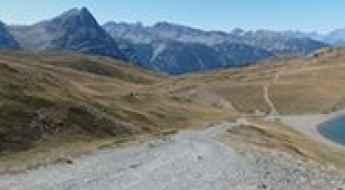
Choosing only a few roads to drive in the country is nearly impossible, as there are about 600 spectacular routes. Stelvio Pass is Europe's most famous road. At an elevation of 2,757m (9,045ft) above sea level, the pass is located in the northern part of the country. It's one of the highest roads in Europe. Featuring 48 hairpin turns, the road through the summit is a marvel of engineering.
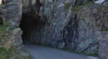
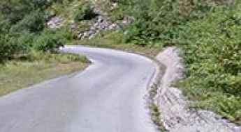
If you prefer coastal drives, you must experience the breathtaking Amalfi Coast Road. The road follows the shoreline from Sorrento south to Salerno. The road has been featured in films since cameras started rolling at 24 frames per second. If you want to feel like James Bond, don’t skip Strada della Forra. A small car with a functioning horn is recommended. For skilled drivers only. The drive is known by motorcyclists from all over Europe, as it is impressive and not without danger in a few narrow and steep spots. If you prefer roads with a story, don’t miss the Strada delle 52 Gallerie, a WWI military mule road. Built on the massif of Pasubio, it was constructed in this position to stay away from Austro-Hungarian artillery fire.
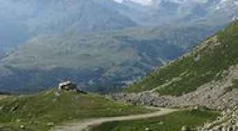
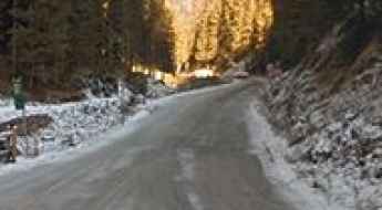
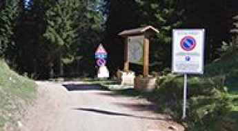
Dal Piaz Refuge
Rifugio Dal Piaz is a high mountain shelter at an elevation of 1.993m (6,538ft) above the sea level, located in the province of Belluno in Veneto, northern Italy.
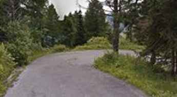
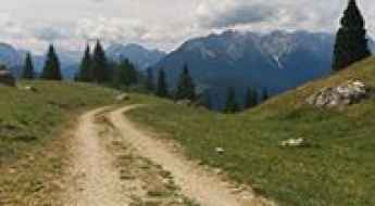
Colle Bettaforca
Colle Bettaforca is a high mountain peak at an elevation of 2.728m (8,950ft) above the sea level, located in Valle d’Aosta region, in northwestern Italy.
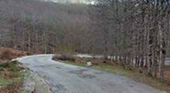
Colle della Vaccera
Colle della Vaccera is a mountain pass at an elevation of 1.461m (4,793ft) above the sea level, located in northwestern Italy.
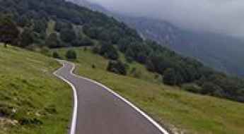
Monte Zovetto
Monte Zovetto is a mountain pass at an elevation of 1.197m (3,927ft) above the sea level, located in Cesuna di Roana, in Vicenza province, Italy.
How to drive the military road to Forte Foens in the Italian Alps?
Forte Foens is a high-altitude military fortress reaching an elevation of 2,186m (7,171ft) above sea level in the Province of Turin, within the Piedmont region of Italy. Built between 1897 and 1899, this battery was part of a strategic defensive line along the southern slopes of the Jafferau massif. Today, the road to the fort is a demanding unpaved track that connects with the legendary Monte Jafferau and the Colletto Pramand, offering one of the most technical and historical driving experiences in the Graian Alps.
Monte della Neve
Monte della Neve is a high mountain peak at an elevation of 2.779m (9,117ft) located in the Province of Sondrio, Lombardy region of the Alps in northern Italy, near the Swiss border.
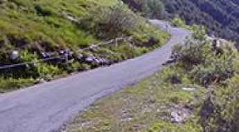
Passo Pertica: Driving the 16 hairpins from Giazza to the High Lessinia
Passo Pertica is a high mountain pass at an elevation of 1,522 meters (4,993 ft) above sea level, located in the Province of Verona in northern Italy. The road to the summit, starting from Giazza, is a technical 9.7-kilometer climb that scales the steep limestone cliffs of the Lessinia Regional Nature Park. The physical reality of this route involves managing a sudden transition from asphalt to a raw gravel surface at the Rifugio Revolto, where the final 2.9 kilometers require a high-clearance vehicle to navigate 16 sharp hairpin turns with a punishing 8.43% average gradient.
How to get by car to Gobba di Rollin?
Gobba di Rollin is a high mountain peak at an elevation of 3.911m (12,831ft) above the sea level, located on the border of Switzerland and Italy. It’s one of the highest roads of Europe.
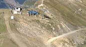
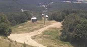
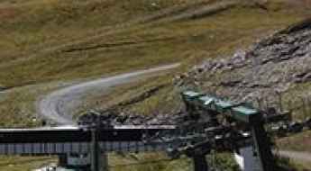
How to drive the steep chairlift track to Platta de Grevon?
Platta de Grevon (also referred to as Piatta de Grevon in some Italian topographic maps) is a high mountain peak at an elevation of 2,715m (8,907ft) above sea level, located in the Valle d’Aosta region of northwestern Italy. Technically, it is one of the highest driveable points in the region, situated within the logistical perimeter of the Pila ski resort. The access route is a service road for chairlift maintenance that ranks among the highest roads in Italy.
Pizzo Groppera
Pizzo Groppera is a high mountain peak at an elevation of 2.242m (7,355ft) above the sea level, located in the Province of Sondrio in the Italian region Lombardy.
Driving to Forte Pozzacchio: The hidden rock fortress of Valmorbia
Located in the heart of the Leno Valleys in Trentino, the route to Forte Pozzacchio (also known as Werk Valmorbia) is a journey into the last frontier of the Austro-Hungarian Empire. Reaching an elevation of 882m (2,893ft) above sea level, this fortress is a masterpiece of military engineering, entirely excavated into the living rock. Reaching it requires navigating the winding roads of the Vallarsa and transitioning from a modern provincial highway to an ancient military track where the history of the Great War is etched into every stone.
Monte Soro: The Ultimate Road Trip Guide
Monte Soro is a high mountain peak at an elevation of 1.848m (6,062ft) above the sea level located in the Italian region Sicily. It’s a great route for its twisty roads, beautiful colors and views.
Colle di Caccia
Colle di Caccia is a high mountain pass at an elevation of 1.840m (6,036ft) above the sea level, located in the Province of Cuneo in the Italian region Piedmont.
Rifugio Monte Curcio: Driving the steep service road in the heart of Sila National Park
Rifugio Monte Curcio is a high-altitude mountain refuge situated at 1,769m (5,803ft) above sea level in the Calabria region of Southern Italy. Located within the scenic Sila National Park, the track leading to the summit is a rugged ski-station service road known for its demanding gradient and unpaved surface.
Solda
Solda, also known as Sulden, is a high mountain town at an elevation of 1.907m (6,256ft) above the sea level, located in South Tyrol, northern Italy.
Fittanze della Sega Pass
Passo Fittanze della Sega is a mountain pass at an elevation of 1.399m (4,589ft) above the sea level, located Parco Regionale della Lessinia, in Italy.
Val Formica Refuge
Rifugio Val Formica is a high mountain refuge at an elevation of 1.658m (5,439ft) above the sea level located in Asiago, Province of Vicenza, Veneto, in northeast Italy.
Prato Nevoso
Prato Nevoso is a ski resort in the Province of Cuneo in the Italian region Piedmont, at an elevation of 1.735m (5,692ft) above the sea level.
Lago Nero
Lago Nero is a high mountain lake at an elevation of 2.014m (6,607ft) above the sea level, located in the Province of Turin in the Italian region Piedmont.
Driving the breathtaking road to Bellecombe is not a piece of cake
Bellecombe is a high mountain peak at an elevation of 2,602m (8,536ft) above sea level, located in the Alps on the French-Italian border. It’s one of the highest roads in the country.
How to drive the steep road to Forcella Zovo in Belluno
Forcella Zovo is a high mountain pass at an elevation of 1.604m (5,262ft) above sea level, located in the province of Belluno of Italy.
How to drive the paved road to Piano dell’Imperatore?
Piano dell’Imperatore is a wide plateau at the foot of Monte Volturino, at an elevation of 1.563m (5,127ft) above sea level, located in the Italian region of Basilicata.
Digola Pass
Passo della Digola is a high mountain pass at an elevation of 1.674m (5,492ft) above the sea level, located in the province of Belluno, in the Italian region of Veneto.
Caval di Novezzia
Caval di Novezzia is a high mountain pass at an elevation of 1.553m (5,095ft) above the sea level, located in the Italian Alps.
Lago di Alpe Gera
Lago di Alpe Gera is a high mountain lake at an elevation of 2.024m (6,640ft) above the sea level, located in the Province of Sondrio in the Italian region Lombardy.
Driving to Col de Saurel: A 2.392m border track in the Cottian Alps
Located on the high-altitude frontier between France and Italy, the track to Col de Saurel is a raw mountain journey in the heart of the Cottian Alps. Reaching an elevation of 2,392m (7,847ft) above sea level, this unpaved route is more than just a border crossing; it is a high-stakes military-origin road that provides access to the crystal waters of Lago di Sette Colori. It is a drive where the mechanical limits of your 4x4 are tested against loose shale and the thin air of the Alpine ridges.
Lago Laudemio
Lago Laudemio is a high mountain lake at an elevation of 1.575m (5,167ft) above the sea level, located in the Southern Italian region of Basilicata.
Colle di Gilba
Colle di Gilba is a high mountain pass at an elevation of 1.528m (5,013ft) above the sea level, located in the Province of Cuneo in the Italian region Piedmont.
Lago del Chiotas
Lago del Chiotas is a high mountain lake at an elevation of 1.978m (6,490ft) above the sea level, located in the Province of Cuneo, Piedmont, Italy.
Bassa dell'Ajet: Driving the historic 1744 military track in Piedmont
Located in the Province of Cuneo in northwest Italy, Bassa dell'Ajet is a high mountain pass reaching an elevation of 2,328m (7,637ft) above sea level. This pass is a key point along one of the most historic military ridges in the Alps, offering a driving experience that combines 18th-century engineering with the raw, high-altitude beauty of the Piedmont region.
Bormio 2000
Bormio 2000 is a ski station at an elevation of 1.938m (6,358ft) above the sea level, located in the Province of Sondrio, Lombardy region of the Alps in northern Italy, near the Swiss border.
How difficult is the unpaved road to Colle di Perascritta in Italy?
Colle di Perascritta is a high mountain pass at an elevation of 2,154m (7,066ft) above sea level, located in the Piedmont region, in northern Italy. Traversed by the rugged and unpaved Strada Sistina, the pass climbs through the Graian Alps toward Lago del Monastero.
Lago di Fontana Bianca
Lago di Fontana Bianca is a high mountain reservoir, at an elevation of 1.900m (6,233ft) above the sea level, located in South Tyrol, northern Italy.
Road SP35
Strada Provinciale 35 is a very challenging road in the Calabria region of southern Italy. The road is very steep with several hairpin turns, offering stunning views of the Tyrrhenian Sea.
Maso Corto-Kurzras: Driving the 2,000m Road in South Tyrol
At an elevation of 2,004m (6,574ft) above sea level, Maso Corto (also known as Kurzras) is a high-altitude settlement at the end of the Schnalstal Valley (Val Senales) in South Tyrol, Italy. The road serves as the primary access for the glacier ski resort and sits near the Austrian border, surrounded by peaks exceeding 3,000 meters.
Driving to Lago di Maulazzo: A scenic mountain road in the Nebrodi Park
Lago di Maulazzo is a beautiful mountain lake at an elevation of 1,453m (4,767ft) above sea level, located in the Messina province of Sicily, Italy. Situated within the Parco Naturale Regionale dei Nebrodi, the road to the lake offers a technical driving experience through one of the largest forested areas on the island.