Scaling the Steep Slopes: Truskmore Mountain's Challenging 22% Gradient Road
Truskmore is a mountain peak at an elevation of 647m (2,123ft) above sea level, located in Ireland. It’s said to be one of the toughest climbs of the country, with some sections up to 22%.
Where is Truskmore located?
The peak, also known as Trosc Mór, is located on the boundary between Sligo and Leitrim counties, in the northern part of the country. It is the highest point in both counties.
Is the road to Truskmore mountain in Ireland paved?
Set high in the Dartry Mountains, the road to the summit is paved but very narrow. It's one of the highest roads of the country. The mountain hosts the Truskmore television transmitter, opened on the 1st February 1962.
How long is the road to Truskmore mountain in Ireland?
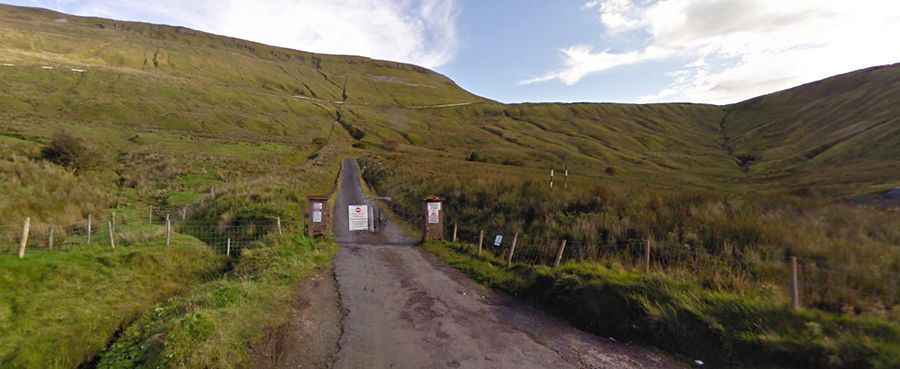
The road to the summit is very steep, hitting a maximum gradient of 22% through some sections. Starting at Ballaghnatrillick, the ascent is 9.0 km (5.59 miles) long. Over this distance the elevation gain is 599 meters. The average gradient is 6.65%. The climb is gentle until the end. This climb comprises two parts: the initial section is gentle, while the second part, spanning 4km, has an average pitch of about 11% and peaks at a gradient of 22%. The last part of the road is private, owned by the national broadcaster RTE and blocked by a barrier.
Is Truskmore mountain in the Dartry Mountains worth it?
The drive offers sweeping views of the surrounding countryside: you can even see across to the sea cliffs of Slieve League. Be careful: there is limited space to park your car safely. The wind can be strong, so definitely check weather conditions before you go up.