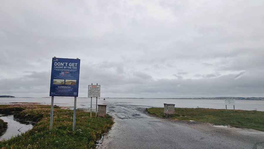
Coney Island's 2.8km Test: Driving the Tidal Causeway Before the Atlantic Swallows It.
Driving in County Sligo, Ireland, often feels like a journey into myth, but few routes are as legendary and genuinely perilous as the one leading to Coney Island. Tucked between the Rosses Point and the Coolera Peninsula, the island sits at the head of Sligo Bay—the largest of three islands guarding the entrance from the wild Atlantic. The most adventurous route to this quiet destination is a drive across the exposed seabed of Cummeen Strand. The moment the tide recedes, a temporary causeway, just 2.8 kilometers (1.73 miles) long, is revealed, demanding utmost respect and clockwork timing from every driver who attempts it. It’s one of the periodically flooded roads around the world.
What Makes the Coney Island Crossing So Risky?
The primary risk associated with this unique tidal road is the unpredictable speed of the incoming Atlantic tide. The exposed path itself is notorious for its rough, rutted sand and the presence of deep saltwater puddles. This constant exposure to corrosive salt requires drivers to be sure to wash their vehicle immediately after returning to avoid corrosion. Crucially, as experienced users warn, you should only attempt the drive if you know your car won't break down halfway across, as the margin for mechanical error is zero. The road demands that the driver be completely aware of the tidal wave timing before even attempting the drive over the strand.
What Is the Physical Composition of This Seabed Road?
The 2.8km path is not a modern structure but an ancient, defined route across the vast mud and sand flats. This particular stretch of Cummeen Strand is sometimes known locally as Dorrin’s Strand, named after a resident who tragically drowned here in 1823. The safe route is paved by a subtle, "sunken road" that lies beneath the sand, providing a firmer base that prevents cars from sinking. This is why drivers are strictly advised to stay within 20 meters of the stone markers—to ensure they remain directly on top of this stable, historic foundation.
How Can Drivers Navigate the Tidal Path Safely?
The way across the strand is guided by 14 stout, cut stone pillars that were erected in 1845. These pillars are intentionally set in line with the main lighthouse, providing a true bearing. Users emphasize that Do not travel at night or in fog, and you need to ring and check for tide times religiously. The 14 pillars are there to guide you should the water come in, but be warned, people who strayed off in the past have drowned. You must stick closely to this line to remain safe. At the end of the day, nature rules—use common sense.
What Lies at the End of This Dangerous Journey?
The island’s name is linked to its history, as Coney is an old Irish word for rabbit—which are still found hopping around the 400-acre island today. The New York landmark, in fact, is said to have been named after this Sligo original by a ship captain who noticed the same abundance of rabbits in the American location. Visitors can explore ancient sites, including the elusive 'fairy forts' and the magical St Patrick’s Well and his wishing chair, making the successful crossing a unique journey back in time.
Road suggested by: jorge manuel gómez sánchez
Pic: Sunny 4444