Sally Gap is one of the best drives of Ireland
Sally Gap is a mountain pass at an elevation of 500m (1,640ft) above sea level, located in County Wicklow, in Ireland.
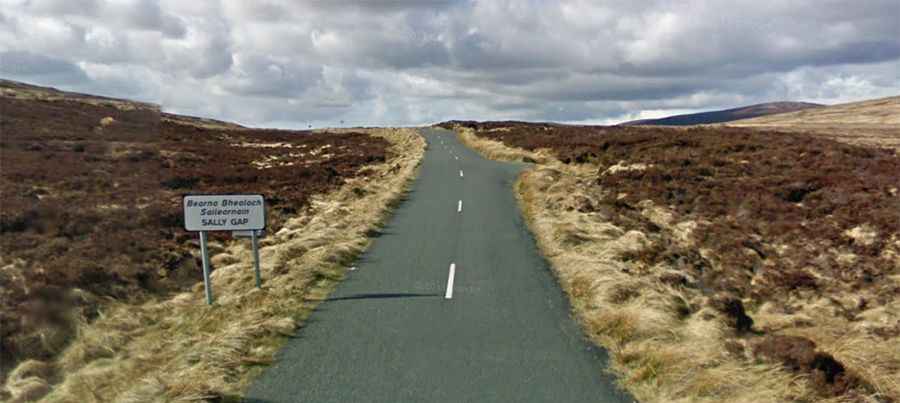
Where is Sally Gap?
The pass is situated to the south of Dublin, on the eastern part of the country, within the Wicklow Mountains National Park.
Can you drive to Sally Gap?
Set high in the Wicklow Mountains, there are two roads to reach the summit (Bearnas na Diallaite in Irish Gaelic), both paved but challenging, with narrow parts and curvy sections.
The Military Road (R115)
Running north-south, the road is known as The Military Road (R115). It’s 38.6 km (23.98 miles) long, running north-south from Rathfarnham (Ráth Fearnáin), a southside suburb of Dublin to Laragh, a small village in County Wicklow. It was constructed between August 12, 1800, and October 1809, by British Army forces, hence the name the Military Road, in the wake of the Irish Rebellion of 1798, to open up the mountains to Crown forces to assist them in tracking down United Irishmen insurgents who were hiding there. Since its construction, it has become an important route across the Wicklow Mountains.
The Sally Gap Road (R759)
Running west-east, the road is R759. Commonly known as Sally Gap Road, it runs from the R755 near Roundwood in East Wicklow to the N81 in West Wicklow. The road is 27 km (17 miles) long.
Is Sally Gap closed?
This winding, twisting feat of engineering is usually open all year round. In winter, it is often dangerous or impassable due to snow and ice, as it is not treated by the Local Authority. It can be prone to extremely cold weather conditions.