If You Love to Drive, You’ll Love the Road to Caha Pass in Ireland
Caha Pass is a mountain pass at an elevation of 320 m (1,049 ft) above sea level, located on the boundary between Cork and Kerry counties in the peninsular southwest region of Ireland.
When Was Caha Pass Built?
Tucked away on the Beara Peninsula, the road was built in 1842 and was known locally at the time as The New Line.
How Long is Caha Pass?
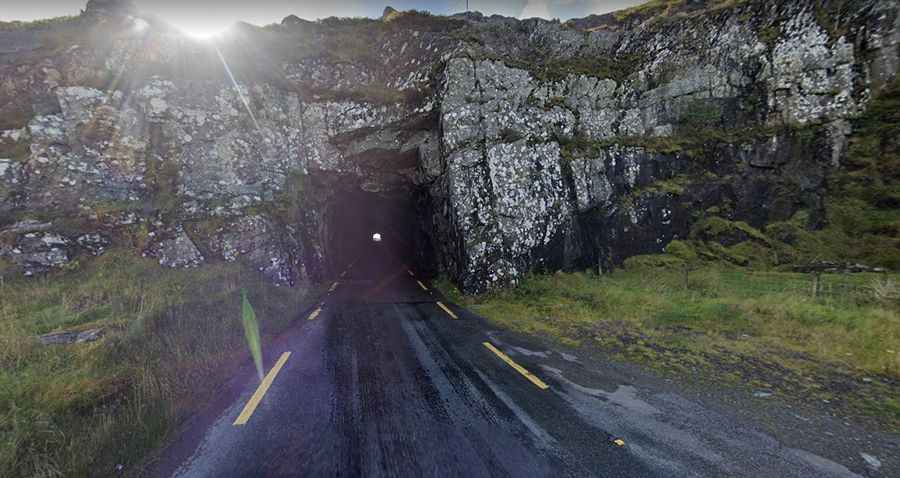
The road to the summit is totally paved. It’s called N71. The pass is 27 km (16.77 miles) long, running south-north from Glengarriff (in County Cork) to Kenmare (in County Kerry). The summit is located inside the Caha Tunnel (Turners Rock Tunnel).
How Long Does It Take to Drive Caha Pass?
To drive the road without stopping will take most people between 25 and 30 minutes. However, the drive is scenic, so it will take longer. This route offers incredible views of the great Irish wilderness. The road can be quite popular in summer.
Is Caha Pass Difficult?
Set high in the Caha Mountains, the road to the summit, known locally as "The Tunnels," is curvy and quite narrow. It’s pretty steep, hitting a maximum gradient of 9% in some sections. Sometimes, the fog adds an even more authentic atmosphere. On the Kerry side, there are multiple tunnels carved into the rock, causing the road to narrow as it passes through.