What are the most spectacular roads in Ireland?
Located in the northwestern part of Europe, Ireland is a country surrounded by the Atlantic Ocean that provides numerous mountain roads and coastal drives.
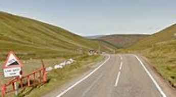
For those preferring mountain roads, the country offers never-ending options. You can try Conor Pass in County Kerry, a mountain pass at 410m (1,345ft) above sea level. The road to the summit snakes through verdant vistas, and its views of the lakes below are the stuff of fairy tales. Healy Pass is another great option, climbing up to 298m (977ft) above sea level, on the boundary between Cork and Kerry counties. And the iconic Sally Gap is one of the best drives in the country, topping out at 500m (1,640ft) above sea level in County Wicklow.
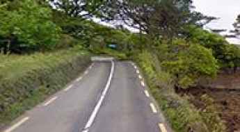
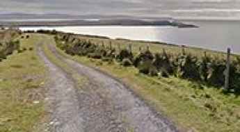
If you’re up for coastal drives, don’t miss Slea Head Drive, a very scenic loop route, beginning and ending in Dingle; it showcases a large number of attractions and stunning views on the western end of the peninsula. It's one of the best coastal drives in the world. Keep in mind, rainfall is common throughout the year, so plan your trips accordingly.
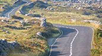
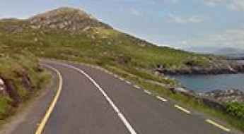
Slea Head Drive is one of Ireland's best coastal routes
Slea Head Drive is a very scenic loop route, beginning and ending in Dingle, Ireland. It showcases a large number of attractions and stunning views on the western end of the peninsula. It's one of the best coastal drives in the world.
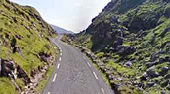
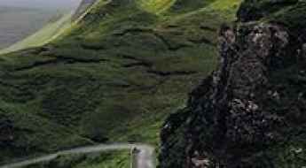
Conor Pass in County Kerry: The Ultimate Road Trip Guide
Conor Pass is a mountain pass at an elevation of 410m (1,345ft) above sea level located in County Kerry, in Ireland. It’s one of the highest roads in the country. The road to the summit snakes through verdant vistas, and its view of the lakes below is the stuff of fairy tales.
Healy Pass is one of Ireland's best drives
Healy Pass is a mountain pass at an elevation of 298m (977ft) above sea level, located on the boundary between Cork and Kerry counties, in the peninsular southwest region of Ireland.
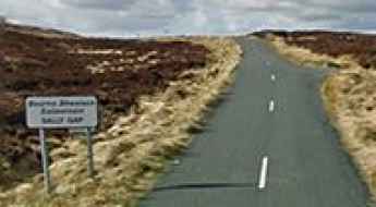
Sally Gap is one of the best drives of Ireland
Sally Gap is a mountain pass at an elevation of 500m (1,640ft) above sea level, located in County Wicklow, in Ireland.
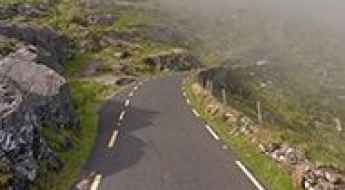
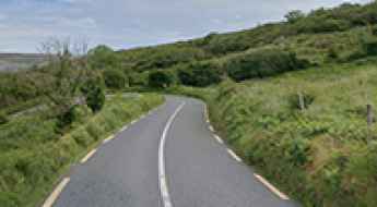
The Old Military Road through the Wicklow mountains of Ireland
The Old Military Road (R115) through the scenic Wicklow mountains is a very picturesque drive straddling Dublin and Wicklow counties in Ireland. It was one of the first purpose-built roads in the country.
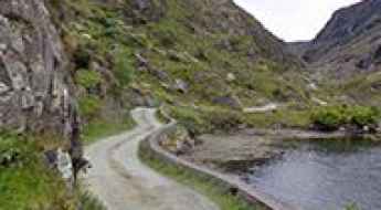
A memorable road trip to Gap of Dunloe in Kerry
Gap of Dunloe is a mountain pass at an elevation of 246m (807ft) above sea level, located in County Kerry, in Ireland. It may be difficult for those who get car sick and for those scared of driving narrow mountain roads.
Cliffs of Moher collapsed
Located on Ireland’s spectacular west coast, a large section of a ledge at the Cliffs of Moher that was the scene of a daredevil cycling stunt has crumbled into the sea. The rockfall served to highlight the danger of getting too close to the popular cliff edge.
Driving 14 of the most scenic roads of Ireland
Ireland is full of epic landscapes and coastal views. Here are the best ones you can find behind a wheel:
Mount Leinster in Ireland: a steep road to the summit
Mount Leinster is a mountain peak at an elevation of 786m (2,578ft) above sea level, located in the province of Leinster, in Ireland. It’s said to be the highest paved road in Ireland.
Wild Atlantic Way is Ireland's Epic Coastal Road
The Wild Atlantic Way stretches 2,500 km (1,553 miles) from Donegal to Cork along Ireland's Atlantic coast. It is known as one of the world's most breathtaking coastal drives.
Scaling the Steep Slopes: Truskmore Mountain's Challenging 22% Gradient Road
Truskmore is a mountain peak at an elevation of 647m (2,123ft) above sea level, located in Ireland. It’s said to be one of the toughest climbs of the country, with some sections up to 22%.
If You Love to Drive, You’ll Love the Road to Caha Pass in Ireland
Caha Pass is a mountain pass at an elevation of 320 m (1,049 ft) above sea level, located on the boundary between Cork and Kerry counties in the peninsular southwest region of Ireland.
Ring of Kerry is a scenic road through majestic landscapes
Situated on the Iveragh Peninsula of County Kerry, in Ireland, Ring of Kerry is one of those bucket-list places you simply must visit.
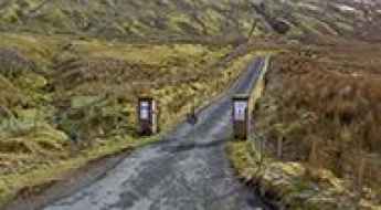
Ballaghbeama Gap: Don’t Attempt This Drive with a Large Car
Located in County Kerry, on Ireland's Iveragh Peninsula, Ballaghbeama Gap is a tight, bendy, and quiet single-track road that requires a high level of skill. Don’t attempt this drive with a large car.
The Most Dangerous Roads In Ireland
Ireland is one of the most beautiful countries in the world. Steeped in history and at the same time playing host to an array of modern cities, it’s a place where the old and the new meet in perfect harmony.
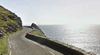
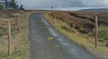
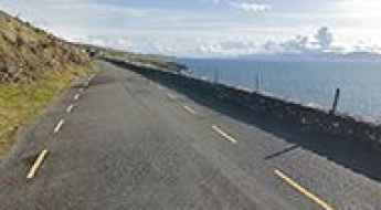
Road R319 Travels by Hairpins to the Edge of the Sea
R319 is a very scenic road located in Achill Island, situated off the coast of County Mayo in Ireland. The drive travels by hairpin turns to the edge of the sea. It’s one of the best coastal drives in the world.
2 roads in Ireland listed in Lonely Planet's Top 50 Epic Drives of the World
Ireland has no shortage of scenic views and breath-taking destinations for adventurous backpackers but, if epic road trips are more up your alley, Ireland won’t disappoint you either.
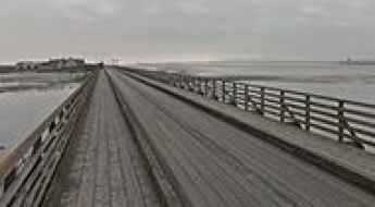
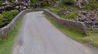
Bull Bridge is an old wooden bridge on Ireland's east coast
Located on Ireland's east coast, the Bull Bridge is one of the most spectacular bridges in the world. This old wooden bridge links Dublin and the North Bull Island in Dublin Bay.
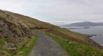
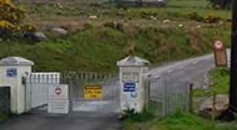
Travelling Through Dursey Road, the Only Road on Dursey Island
Dursey Road is the only road on Dursey Island, located at the southwestern tip of the Beara Peninsula in Ireland.
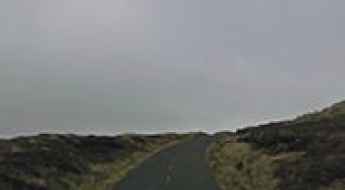
The Ultimate Guide to Traveling the Road R440 to Dossaun Mountain
Dossaun Mountain is a mountain pass at an elevation of 453m (1,486ft) above sea level, located in Ireland.

Safety Tips for Slea Head Drive in Ireland
Slea Head Drive is one of Ireland’s most scenic routes, offering breathtaking views, historic landmarks, and quaint villages. Winding along the Dingle Peninsula, it’s as beautiful as it is unpredictable. However, travelers should note that this stunning drive is also considered one of the most dangerous roads in the country. Planning ahead and prioritizing safety will ensure a memorable and safe experience.
What are the highest roads in Ireland?
The Republic of Ireland (Éire) is the third-largest island in Europe, situated in the North Atlantic Ocean off the west coast of Great Britain. While famed for its gentle, rolling landscape of lush green fields and central lowlands, Ireland's geography is dramatically framed by a surrounding ring of rugged coastal mountains.
Kippure: The Ultimate Road Trip Guide
Kippure (Cipiúr) is a mountain peak at an elevation of 750m (2,460ft) above the sea level, located on the boundary between Wicklow and Dublin counties, on Ireland's east coast. It's one of the highest roads of the country.
Driving the wild road to Mullaghanish
Mullaghanish is a mountain peak at an elevation of 649m (2,129ft) above the sea level, located on the boundary between Cork and Kerry counties, in the southwest of Ireland. It's one of the highest roads of the country.
An epic road to Clermont Carn in Ireland
Clermont Carn is a mountain peak at an elevation of 495m (1,624ft) above the sea level, located in County Louth, Republic of Ireland, at the border with Northern Ireland.
5 Risky Irish Roads That Are Not Easy to Drive
Driving in Ireland offers a unique experience, especially on routes that traverse the country's rural, mountainous, or coastal landscapes. While scenic, some roads present notable challenges due to their narrow width, sharp turns, variable weather, or shared usage with pedestrians and livestock. Below is a look at five roads in Ireland that are known for being particularly demanding for drivers.
Corkscrew Hill is a thrilling drive through time on Ireland's historic route
Corkscrew Hill, located in County Clare, Ireland, offers a historic drive through the Burren region.
Ireland's Wild Roads: A Thrilling Road Trip on the Edge of Adventure
When it comes to embarking on a road trip, there are few places as captivating and awe-inspiring as Ireland.
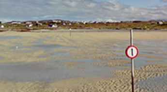
The road to Omey Island off the coast of Connemara gets swallowed by the sea
Omey Island is a small tidal island located in County Galway, Ireland. It’s accessible via a periodically flooded causeway known as Omey Tidal Road. It’s one of the periodically flooded roads around the world.
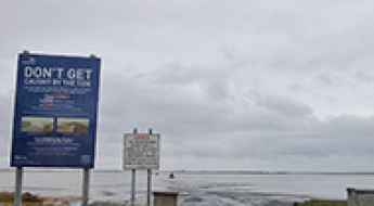
Coney Island's 2.8km Test: Driving the Tidal Causeway Before the Atlantic Swallows It.
Driving in County Sligo, Ireland, often feels like a journey into myth, but few routes are as legendary and genuinely perilous as the one leading to Coney Island. Tucked between the Rosses Point and the Coolera Peninsula, the island sits at the head of Sligo Bay—the largest of three islands guarding the entrance from the wild Atlantic. The most adventurous route to this quiet destination is a drive across the exposed seabed of Cummeen Strand. The moment the tide recedes, a temporary causeway, just 2.8 kilometers (1.73 miles) long, is revealed, demanding utmost respect and clockwork timing from every driver who attempts it. It’s one of the periodically flooded roads around the world.