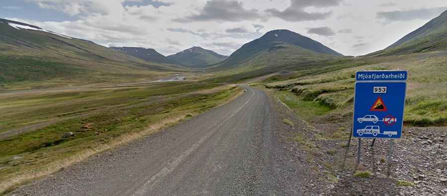
How to drive the gravel Road 953 (Mjóafjardarvegur) to Dalatangi Lighthouse?
Road 953 (Mjóafjarðarvegur) is a legendary gravel track located in the Eastfjords of Iceland. Known for being one of the steepest and most isolated routes in the country, it leads to the tiny village of Mjóifjörður and the remote Dalatangi Lighthouse.
Running along the northern shore of Mjóifjörður—often called the wildest fjord in the region—this road is a true test of nerves. The route is carved into steep cliffs with the roaring North Atlantic Ocean directly below. It is a journey for those who don't suffer from vertigo, offering breathtaking views of deep blue waters and untouched glacial vales.
| Road facts: Road 953 (Mjóafjarðarvegur) | |
|---|---|
| Location | Eastfjords, Iceland |
| Length | 45.9 km (28.5 miles) |
| Max Gradient | 18% |
| Season | Summer only (Closed in winter) |
| Surface | Gravel / Narrow |
How difficult is the drive to Dalatangi Lighthouse on Road 953?
The road is an extraordinary piece of engineering, but it requires slow and careful driving. It is a narrow winding road full of gravel. The track is notably narrow and features extreme steep sections with gradients up to 18%, especially during the descent into the fjord. Due to the loose gravel and the sharp turns, 4WD vehicles are highly recommended.
Where does Road 953 lead?
The road is 45.9 km (28.5 miles) and ends at the Dalatangi Lighthouse, which was the first lighthouse ever built in Iceland.
Is Road 953 worth the drive?
The drive offers unparalleled views overlooking the river mouths of Loðmundarfjörður and Seyðisfjörður. Along the way, you will drive past the magnificent Klifbrekkufossar waterfalls, which tumble in multiple tiers right alongside the road. This is a road trip for photographers and adventurers who want to experience the rawest side of Iceland's coast, far away from the busy Ring Road traffic.
When can I drive Road 953 to Dalatangi Lighthouse?
The road is only open during the short Icelandic summer. It’s very slippery when wet. Because the road is so challenging and isolated, driving at night or in poor visibility (common in the Eastfjords) is not recommended.