Road trip guide: Conquering Námaskarð Pass
Námaskarð is a mountain pass at an elevation of 409m (1,341ft) above sea level, located in Iceland. The area is otherworldly, a sulfuric martian landscape.
Where is Námaskarð Pass?
Set high in the northern part of the country, the area has recorded the low-temperature record for Iceland (-38°C). While exploring Námaskarð, be sure not to touch any of the running water, as it is likely to be boiling.
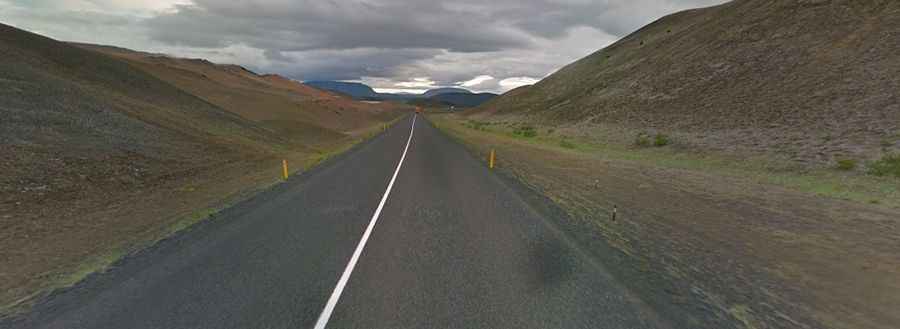
Is the road to Námaskarð Pass paved?
The road through the pass is fully paved. It’s called Route 1 (Ring Road), which encircles the country. The road is mostly straight.
How long is the road through Námaskarð Pass?
The pass is 36km long, running west-east from Reykjahlíð (a village situated on the shores of Lake Mývatn) to the Suspension Bridge over Jökulsá á Fjöllum near Grímsstaðir.