The Ultimate F821 Road Adventure: Navigating Iceland's Eyjafjarðarleið in Extreme Conditions
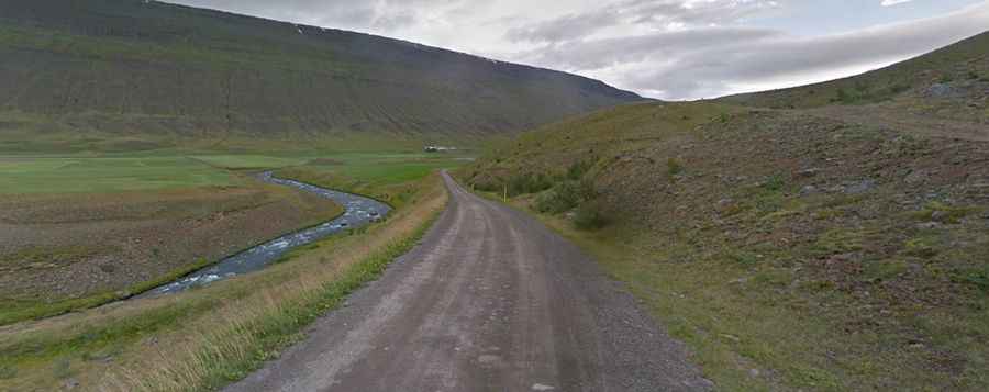
F821 (Eyjafjarðarleið) is a defiant road located in the Northeastern Region of Iceland. Travelers need to be well prepared with enough food, water and fuel for the drive ahead.
Is the F821 (Eyjafjarðarleið) unpaved?
Tucked away on the northern part of the island, the road is totally unpaved and very rough at times but there are no big rivers to cross (just a few small streams). It features big potholes and rocks. In order to drive this road up, you need a 4x4 with high clearance. It’s very steep and narrow in parts.
Is the F821 (Eyjafjarðarleið) road open?
It's the highest road of the country, topping out at 944m (3,097ft) above sea level. Snow might fall, but heavy snow fall does not happen in the valley in summer time when the road is open and avalanches are unlikely. Landslides occur sometimes after long and heavy rain, but not always. This rough trail is only open in the summer (usually July through September).
How long is the F821 road in Iceland?
The road, also called Eyjafjarðarleið, is 41km (25.47 miles) long and runs from the farm Hólsgerði deep in the valley of Eyjafjarðadalur up to the highland and the arctic desert Sprengisandur. It’s one of the famous F Roads of the country.
Road suggested by: Glenn Fant