The wild road to Bolafjall Mountain is subject to strong winds
Bolafjall is a mountain peak at an elevation of 615 meters (2,017 feet) above sea level, located in Bolungarvíkurkaupstaður, Iceland. The summit offers spectacular views, and on a clear day, some people claim you can see all the way to Greenland.
Where is Bolafjall Mountain?
The mountain is located in the Westfjords, a large peninsula in the northwestern part of the country.
Is the road to Bolafjall Mountain unpaved?
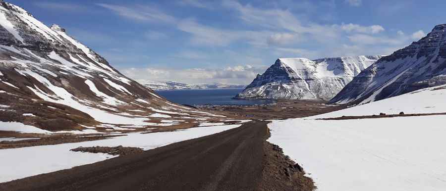
The road to the summit is unpaved in pretty good condition. It’s called 630. A 4x4 vehicle is recommended. You can drive up there with any car but the road is a little dangerous when you need to bypass another car or something. If you’re afraid of fog, don’t go late at night because it might be scary to go down. You need to do this drive on a clear day, as even just a bit of “weather” would seriously reduce visibility.
Is the road to Bolafjall Mountain open in winter?
The road is only open to tourists during the summer months, usually between late June and early September.
How long is the road to Bolafjall Mountain?
As with many mountain roads, it is steep (with sections up to 10%) without a lot of room to get over for other cars. Starting from the fishing town of Bolungarvik, one of Iceland’s northernmost towns, the ascent is 8.9km (5.53 miles) long. Over this distance the elevation gain is 606 meters. The average gradient is 6.80%, with some parts up to 12%.
Is the drive to Bolafjall Mountain worth it?
At the summit there is a former US radar station known as Latrar Air Station now operated by the Icelandic Coast Guard. Built in 1992, it closed in 2006. Recently, a viewing platform was built, with staggering views over Ísafjarðardjúp, Jökulfirðir, and some people say all the way to Greenland.
Pic: Полина Носарева