All about the infamous road to Dyrholaey Lighthouse
Located in the Southern Region of Iceland, Dyrholaey Lighthouse is a century old lighthouse on an isolated clifftop.
Where is Dyrholaey Lighthouse?
Located at the southernmost point of Iceland's mainland, near the small village of Vík í Mýrdal, the lighthouse is just 43 feet tall, with excellent views of the North Atlantic Ocean. The present lighthouse was built in 1927. While you can’t go inside the Dyrholaey Lighthouse, you can walk around the exterior.
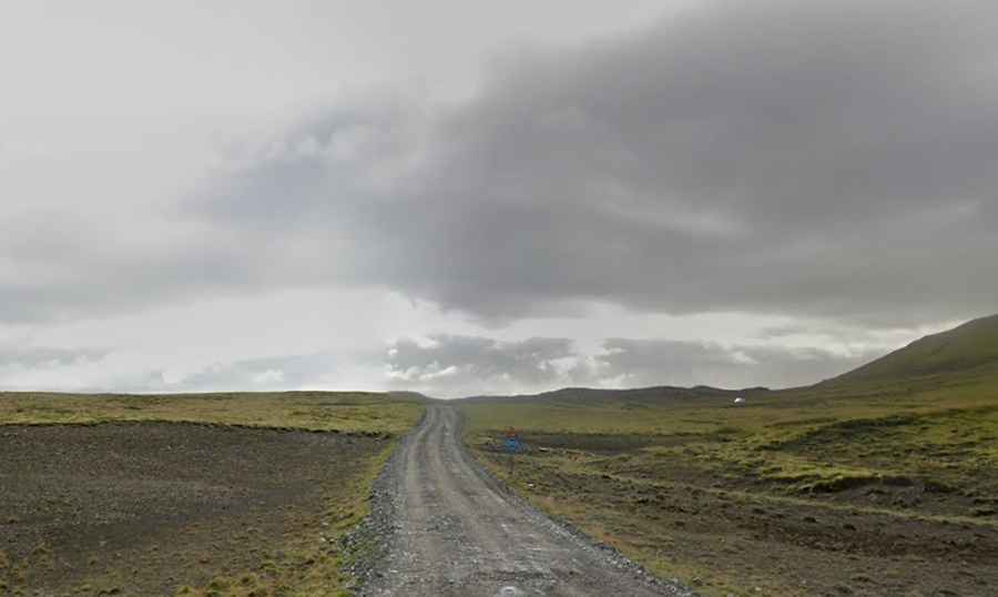
How long is the road to Dyrholaey Lighthouse?
The road to the lighthouse has paved and unpaved sections. It’s called 218 road (aka Dyrholavegur road). Starting on the main Route 1, commonly known as Ring Road, east from Reykjavik, the road to the lighthouse is 6,5 km (4.03 miles) long.
Why is the road to Dyrholaey Lighthouse famous?
The paved section has a tiny stretch in the middle of Dyrhólaós lake. It can be flooded after heavy rain storms or tidal flooding due its proximity to sea. Tidal flooding usually occurs through the combination of winds, offshore storms, and full moon cycles. After rains, the unpaved part becomes clay and mud, catching out those who ignore the 4WD only signs and attempt it in a 2WD car. You might encounter some snow and ice on the roads during the winter, which requires more careful driving. Note that during spring/summer time or nesting season Dyrhólaey has limited access.
Road suggested by: jorge manuel gómez sánchez