What are the most spectacular roads in Iceland?
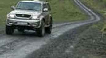
Located in the northern part of Europe, Iceland is a country that provides an unparalleled road trip experience, with mountain roads and coastal drives, mixed with 4x4 trips. Some of the roads, due to their dangerousness, are for 4x4 vehicles only. Others are just for special vehicles, having to cross rivers.
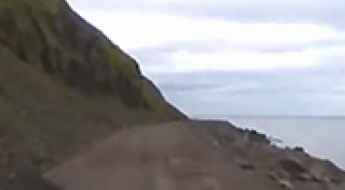
Tucked away in the North Atlantic Ocean, the country covers 103,000 square kilometers. It’s famous for its dramatic landscapes with volcanoes, geysers, hot springs, lava fields, and roads. When traveling to the country, be sure to drive Road 622, a hazardous drive below sea level when the tide is high; it’s one of the most challenging drives on Earth, with the road carved into and under cliffs. Driving this road is possible if you have a Jeep, 4x4 experience, time, and strong nerves.
Another must-do is driving the Askja Road, one of Earth’s most scenic trips. It’s a winding dirt track running towards the Askja volcano, a stratovolcano situated in a remote part of the central highlands. The road has some challenging sections with several fords and river crossings. Keep in mind, it’s a very dangerous drive. If you prefer paved roads, the Diamond Circle is an epic adventure for you. Running through the most incredible spots in the northeastern part of Iceland, it is an epic and unforgettable adventure.
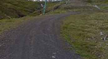
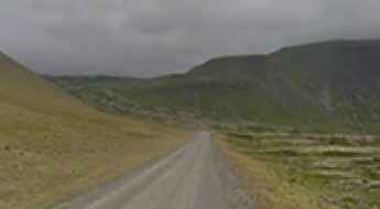
How to drive the unpaved road to Ennisháls Pass?
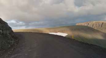
Ennisháls Pass is a mountain pass at an elevation of 280m (918ft) above sea level, located in Strandabyggð, in Iceland.
F508 (Skorradalsvegur): Driving the technical mountain track in Iceland
The F508, also known as Skorradalsvegur, is a technical mountain track located in the Western Region of Iceland. This route serves as a high-altitude link between Road 508 (near the Skorradalsvatn lake) and Road 52 (Uxahryggjavegur). As one of the F-roads in Iceland, it crosses a rugged volcanic landscape where the roadbed is defined by deep ruts, river crossings, and total isolation.
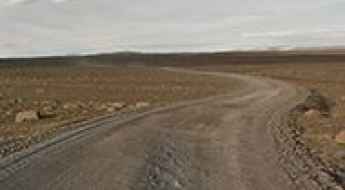
Road 590 (Klofningsvegur)
Road 590 (Klofningsvegur) is a very scenic bumpy route located in the mountainous Klofningsvegur Peninsula, in Western Region, on the western coast of Iceland.
The unpaved road to Lake Frostastaðavatn
Lake Frostastaðavatn is a highland lake at an elevation of 573m (1,879ft) above the sea level, located in the south of Iceland.
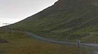
Siglufjardarskard Pass requires slow, careful driving
Siglufjardarskard is a mountain pass at an elevation of 701m (2,299ft) above the sea level, located on the border of Northeastern and Northwestern regions, in the north of Iceland. The road is not for those who are afraid of height. The road requires slow, careful driving.
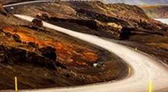
Road trip guide: Conquering Námaskarð Pass
Námaskarð is a mountain pass at an elevation of 409m (1,341ft) above sea level, located in Iceland. The area is otherworldly, a sulfuric martian landscape.
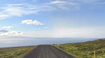
How do you get to Dettifoss waterfall in Iceland?
Located in the Northeastern Region of Iceland, Dettifoss waterfall is said to be the second most powerful waterfall in Europe measured by volume of water.
Almannaskard Pass
Almannaskard is a mountain pass at an elevation of 162m (531ft) above the sea level, located in the Eastern Region of Iceland.
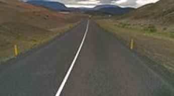
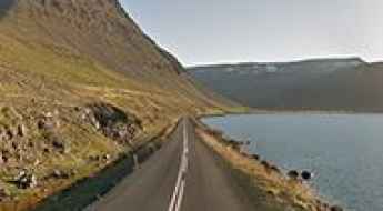
Road 626 is an awe-inspiring drive in the peninsula Westfjords
Road 626 (Hrafnseyrarvegur) is the name of a very scenic drive located on the coast of the fjord Dýrafjörður in the mountainous peninsula Westfjords of Iceland.
Road F903 (Hvannalindavegur): Driving the technical river crossings to Vatnajökull
The F903, also known as Hvannalindavegur, is a technical mountain track located in the Eastern Region of Iceland, within the Vatnajökull National Park. This high-altitude route connects the F910 road with the F902 road, heading toward the Kverkfjöll glacier. As one of the most demanding F-roads in Iceland, it crosses a desolate landscape of volcanic sand, lava fields, and glacial rivers.
All about the infamous road to Dyrholaey Lighthouse
Located in the Southern Region of Iceland, Dyrholaey Lighthouse is a century old lighthouse on an isolated clifftop.
How to Drive Safely in Iceland
Driving in Iceland requires a specific understanding of high-latitude logistics and terrain classification. The road network ranges from the paved Ring Road (Route 1) to the highly technical F-roads in the interior highlands. Navigating these routes involves managing river crossings, loose volcanic gravel, and extreme weather shifts that can compromise vehicle integrity in minutes.
When do F-roads in Iceland open?
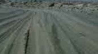
When can travelers expect the enchanting F-roads of Iceland to open up for exploration? These rugged, unpaved gravel paths beckon adventurers towards the breathtaking inner reaches of the country, known as the highlands. Renowned as mountain roads or highland roads, these F-roads often present thrilling challenges, including daring river crossings. However, with careful planning and a suitable vehicle, embarking on these F-roads becomes an unforgettable experience, as the Icelandic highlands that surround them are unparalleled in their natural beauty and serene tranquility.
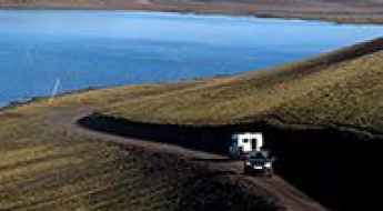
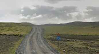
Road trip guide: Conquering Steingrimsfjörðurheiði pass
Steingrimsfjörðurheiði pass is a mountain pass at an elevation of 440m (1,443ft) above the sea level located in the Icelandic Westfjords.
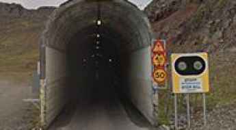
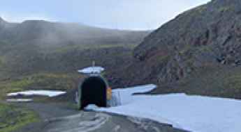
Oddsskardsgong
Oddsskardsgong is a mountain tunnel at an elevation of 631m (2,070ft) above the sea level, located in eastern Iceland.
How To Travel The Road 619 In Iceland
Road 619 (Ketildalsvegur) is the name of a very scenic drive located on the coast of Arnarfjörður, one of the Westfjords in Iceland.
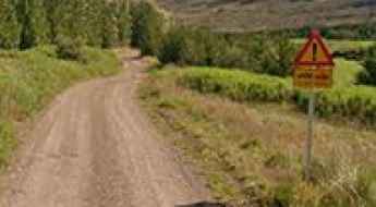
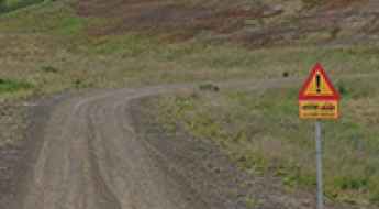
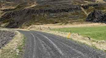
Road 24 (Ingjaldssandsvegur)
Located on the Westfjords, a large peninsula in northwestern Iceland, Road 24 (Ingjaldssandsvegur) is one of the most remote drives of the country. The road requires slow, careful driving.
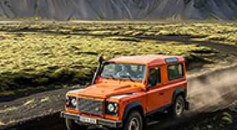
Unveiling Iceland's Wild Side: Top 9 Thrilling Tours Along Its Most Dangerous Roads
Iceland, a land of stark contrasts and untamed beauty, beckons the brave and the bold to explore its mesmerizing landscapes. From the bustling city life of Reykjavik to the remote, wild terrains, the country offers a blend of experiences that are both enchanting and exhilarating. Among these, the thrilling tours along Iceland's most dangerous roads stand out, offering adventurers an unparalleled experience of the island's raw and rugged charm.
How to drive the Single Lane Tunnels/Bridges of Iceland?
In Iceland, some tunnels and bridges have only one lane, especially in rural areas. While they are not numerous, it's important to remember the rules before driving through them. The key thing to know is how to handle oncoming traffic. If you're in a tunnel and there's a passing place on your right, you must pull over to allow the other vehicle to pass.
Driving the Scenic Road 832 Through Vadlaheidi Pass in North Iceland
Vaðlaheiði is a mountain pass at an elevation of 544m (1,784ft) above sea level, located in northern Iceland. The road to the summit is closed to passenger vehicles—4x4 only. At this elevation, it’s one of the highest roads in the country.
Conquering Iceland’s Interior: A First-Timer’s Guide to F-Roads
Iceland’s well‑paved Ring Road is spectacular, but the real test for adventure drivers lies beyond the asphalt, deep inside the island’s volcanic highlands. Here, unbridged rivers slice through lunar deserts, weather shifts without warning, and the only certainty is gravel crunching beneath your tyres. These rugged tracks are signed with a single letter: F. Short for fjallvegur (mountain road), F‑roads are 4×4‑only, seasonal, and unapologetically wild.
How To Have The Ultimate Road Trip To Kollafjardarheidi Pass?
Kollafjarðarheiði is a high mountain pass at an elevation of 464m (1,522ft) above the sea level, located in the West Fjords peninsula of Iceland.
A wild drive to Brokartindur through Vatnajokull Glacier
Brókartindur is a mountain peak located in the southeastern part of Iceland. As a part of the vast Vatnajokull National Park, reaching its summit requires a 4x4 modified vehicle.
How To Have The Ultimate Road Trip Through Haukadalsskardh Pass
Haukadalsskarð is a mountain pass at an elevation of 375m (1,230ft) above sea level, located on the western coast of Iceland.
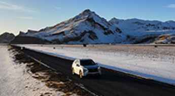
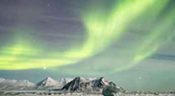
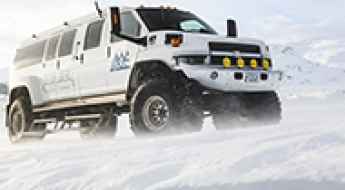
Driving in Iceland in Winter: How to Enjoy a Safe and Magical Road Trip
Winter in Iceland is a season of quiet beauty. Snow blankets the mountains and lava fields, waterfalls transform into sparkling sculptures of ice, and the Northern Lights cast a green glow across the dark sky. For many travellers, it’s the most magical time to explore the country.