How to get by car to Skaloti Gorge in Crete?
Skaloti Gorge is a canyon located on the south coast of the Greek island of Crete, within the Fragokastelo region. The gorge is approximately 2 km long, starting from the Manikas plateau and descending toward the seaside village of Skaloti at the foot of the White Mountains.
Where is the road to Skaloti Gorge located?
The road runs in a north-south direction, connecting the village of Kallikratis with Skaloti. The route traverses the Skaloti Gorge near its southern terminus and provides access to the Άγιος Μανώλης (Agios Manolis) church.
| Road facts: Skaloti Gorge | |
|---|---|
| Elevation | 943 m (3,093 ft) |
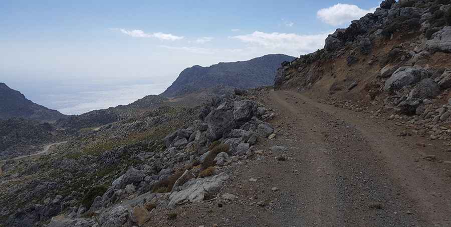
| Length | 12 km (7.45 miles) |
| Surface | Unpaved / Gravel |
| Hairpin Turns | 14 |
Is the road to Skaloti Gorge paved?
The route is entirely unpaved, consisting primarily of loose gravel with limited concrete sections. The track is narrow, with several sections where the width is insufficient for vehicles to pass each other.
What are the driving conditions on Skaloti Road?
The road reaches a maximum elevation of 943 meters above sea level. It features 14 hairpin turns and steep gradients as it descends toward the coast. Due to the loose surface and the technical nature of the twists and turns, high-clearance vehicles are recommended.
What can be seen at the summit?
At the highest point of the route, there is a viewpoint offering visibility of the Libyan Sea and the surrounding coastal plain of Fragokastelo. The canyon walls become vertical as the road nears the seaside village of Skaloti.
Road suggested by: Christian Claus