Driving to Radomir: A brutal 2.031m unpaved pass on the Bulgaria-Greece border
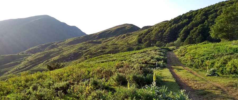
Located on the rugged boundary between Bulgaria and Greece, the track to Radomir (also known as Kalabak) is a high-altitude challenge in the heart of the Belasica mountain range. Reaching an elevation of 2,031m (6,663ft) above sea level, this is one of the highest motorized routes in the region, linking the Petrich Municipality in Bulgaria with the Serres regional unit in Greece. It is a journey through a landscape of dense forests and exposed ridges where the mechanical stamina of your vehicle is the only thing that matters.
| Road facts: Radomir Pass | |
|---|---|
| Location | Bulgaria–Greece border (Belasica) |
| Elevation | 2,031 m (6,663 ft) |
| Length | 18.6 km (from Petrich) |
| Elevation Gain | 1,764 m |
| Average Gradient | 9.48% |
How challenging is the 18.6km ascent to Radomir?
The drive to Radomir starts from Petrich and covers 18.6 km of relentless climbing. With a staggering vertical gain of 1,764 meters, the average gradient is 9.48%, but don't let that number deceive you; several sections feature much steeper ramps on loose, shifting ground. The road is entirely unpaved and, as seen in the local topography, it is often battered by erosion and heavy snowmelt. Navigating this track requires a 4x4 vehicle with high clearance, as the deep ruts and jagged rocks can easily snag the undercarriage of a standard car. It is a slow, technical grind that forces your engine to work at high revs with minimal cooling airflow.
What are the hazards of the Belasica border road?
Being one of the highest mountain passes of Greece and Bulgaria, the Radomir pass is subject to extreme weather shifts. The road is typically blocked by snow for more than half the year, and even in summer, sudden thunderstorms can turn the dry dirt into a muddy trap. The track is narrow, often hugging the ridge with unprotected drops that offer no margin for error. As it is a border zone, historical military restrictions often mean the road lacks any modern maintenance, leaving you to deal with fallen trees and rockslides that can block the 18.6 km journey without warning.
What is the best 4x4 strategy for the Bulgarian-Greek frontier?
Reaching the summit of Radomir requires total self-sufficiency. There is zero infrastructure on this route, and cell service is unreliable in the deep canyons of the Belasica range. You must air down your tires to maximize grip on the loose stones and ensure your low-range gearbox is functioning perfectly. On the descent, do not ride your brakes; the nearly 1,800-meter drop will cause them to smoke and fail before you even reach the halfway point. Use heavy engine braking and pick your line carefully through the washouts. In this part of the Balkans, the road is a test of mechanical endurance and driver focus—respect the verticality and monitor your fuel levels for the long return trip.
Pic: Стойчо Георгиев