Wallberg Road: Driving the 11.92% Service Track in Upper Bavaria
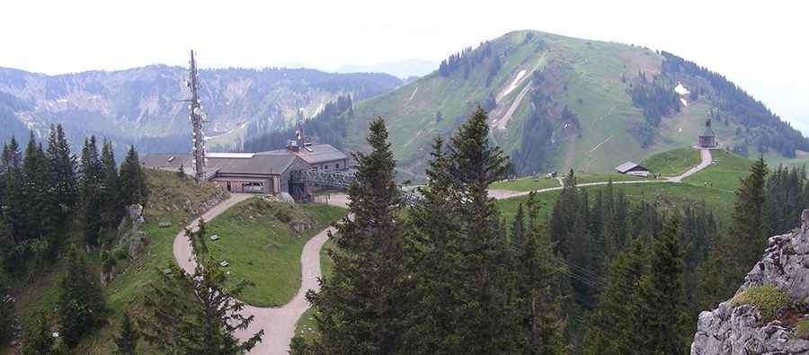
Reaching an elevation of 1,564m (5,131ft) above sea level, Wallberg is a high mountain peak located in the district of Miesbach, in Upper Bavaria, Germany. Situated within the Mangfall Mountains, part of the Bavarian Alps, the summit is a prominent logistical hub for regional communication facilities.
| Road facts: Wallberg | |
|---|---|
| Location | Miesbach, Bavaria, Germany |
| Elevation Gain | 835 m |
| Length | 7 km (4.35 miles) |
| Average Gradient | 11.92% |
| Surface | Gravel / Service Track |
How is the road to Wallberg?
The ascent to Wallberg starts from Rottach-Egern. The road to the summit is 7 km (4.35 miles) long and consists of a steep gravel track. Over this distance, the elevation gain is 835 meters, resulting in a sustained average gradient of 11.92%. The surface is composed of compacted alpine gravel, but it remains narrow and features several technical hairpins designed for service vehicle transit. The road provides access to the various communication towers and facilities located at the summit ridge.
Is the road to Wallberg open to private vehicles?
The final section of the track to Wallberg is strictly closed to private motorized traffic. Access is reserved for authorized maintenance personnel, emergency services, and supply vehicles for the mountain inn. The high density of hikers and mountain bikers on the track makes any unauthorized driving extremely hazardous. Visitors typically access the summit via the Wallbergbahn cable car or by foot, as the 11.92% slope and narrow geometry are not suitable for general public driving.
What are the driving hazards on the Wallberg service track?
For authorized vehicles, the primary hazards on the Wallberg track include extreme gradients and high pedestrian transit. The 11.92% average slope means some ramps are significantly steeper, putting immense thermal stress on braking systems during the descent. Weather conditions at 1,564m can change rapidly, with heavy snowfalls often leaving the track impassable from late autumn until spring. Rapid icing on the gravel surface is common, requiring specialized 4x4 equipment and low-range gearing for any operational transit.
How does weather affect the road to Wallberg?
Due to its exposure in the Mangfall Mountains, Wallberg is subject to harsh alpine weather. The road is not cleared of snow for public use, and winter closures are permanent for several months. During the shoulder seasons, thunderstorm activity can wash out sections of the gravel, creating deep ruts that require high-clearance vehicles. High-velocity winds are frequent at the summit facilities, which can impact vehicle stability on the most exposed ridges of the 7 km climb.
Pic: Ewald Schlembach