How to drive the steep gravel track to Ostlerhütte?
Ostlerhütte is an alpine mountain hut at an elevation of 1,797 meters (5,895 ft) above sea level in the Ostallgäu district of Bavaria, Germany. Located on the Breitenberg summit in the Allgäu Alps near the Austrian border, the supply track ranks among the highest roads of Germany. Private motor vehicle traffic is prohibited.
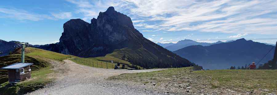
| Road facts: Ostlerhütte | |
|---|---|
| Location | Pfronten, Ostallgäu, Bavaria (Germany) |
| Elevation | 1,797 m (5,895 ft) |
| Length | 6.6 km (4.10 miles) from Achtalstraße |
| Elevation Gain | 753 m (2,470 ft) |
| Average Gradient | 11.40% |
| Surface | Unpaved (Coarse gravel, loose stones, and dirt) |
| Access | Restricted / Authorized supply and emergency 4x4 vehicles only |
Where is the road to Ostlerhütte located?
The track starts from Achtalstraße near Pfronten, in the Ostallgäu district of Bavaria. The 6.6-kilometer supply route gains 753 vertical meters to reach the 1,797-meter hut on the Breitenberg ridge.
How steep is the track to Ostlerhütte?
The 6.6-kilometer climb maintains an average gradient of 11.40%, with inner hairpin curves exceeding 15%. The unpaved surface consists of loose gravel and stones, requiring a low-range 4x4 to maintain traction without spinning wheels on steep ramps.
What hazards exist on the route to Ostlerhütte?
The narrow single-lane path lacks safety barriers along open mountain slopes. Descending 753 meters over 6.6 kilometers puts heavy strain on vehicle brakes, requiring engine braking in low gear. Heavy rain turns the gravel into slick mud, while the summit site offers minimal turning space for larger utility vehicles.
Is the road to Ostlerhütte open in winter?
No. Deep snow buries the 6.6-kilometer track throughout winter, closing the route to all vehicle traffic. During the cold months, the road functions exclusively as a winter hiking and sledding trail.
Pic: Alexis Alexokratis