How to drive the unpaved road to Serre Doumenge?
Serre Doumenge is a high mountain peak at an elevation of 2.232m (7,322ft) above sea level, located in France.
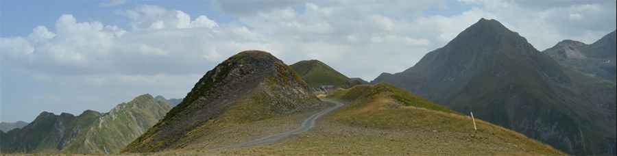
Where is Serre Doumenge?
The peak is located on the border of Haute-Garonne and Hautes-Pyrénées departments, in the south-western part of the country.
Is the road to Serre Doumenge unpaved?
The road to the summit is totally unpaved, with loose stones, narrow, and defiant drops. It’s a rugged chairlift access trail. 4x4 vehicles only.
How long is the road to Serre Doumenge?
Starting from the parking lot for Peyragudes ski resort, the road to the summit is 4.8 km long. Over this distance, the elevation gain is 650 m and the average gradient is 13.54%.
Is the road to Serre Doumenge open in winter?
Set high in the Pyrenees, the road is totally impassable in winters. The road is only accessible during a very narrow time-frame in late summer. For the majority of the year, the track is buried under deep snow and is part of the Peyragudes ski resort. Even in July, patches of snow can remain on the north-facing slopes.
Pic: S. C.