Road to Lac Long Supérieur: Driving the 2,500m Restricted Track in the Mercantour
Located in the Alpes-Maritimes department of southeastern France, Lac Long Supérieur is a high-altitude glacial lake reaching an elevation of 2,500m (8,202ft) above sea level. Situated within the core zone of the Mercantour National Park, the track leading to the lake is a restricted mountain corridor used for park maintenance and mountain refuge logistics.
| Road facts: Lac Long Supérieur | |
|---|---|
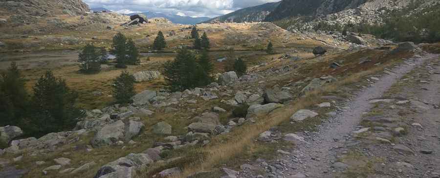
| Location | Vallée de la Gordolasque, France |
| Elevation | 2,500 m (8,202 ft) |
| Access | Restricted (Authorized 4x4 Service Only) |
| Surface | Unpaved / Granite Scree |
| Hazard Level | Extreme (Steep Gradients & Exposure) |
How is the road to Lac Long Supérieur?
The ascent toward Lac Long Supérieur is a high-gradient mountain track that starts from the upper reaches of the Gordolasque valley. The surface is entirely unpaved, consisting of loose granite rocks and unstable scree. The road is engineered to overcome a massive vertical drop in a short distance, featuring sustained ramps that require a high-clearance 4x4 vehicle with low-range gearing. Due to its protected status within the Mercantour National Park, motorized transit is strictly regulated and limited to authorized personnel, as the track cuts through sensitive alpine ecosystems and archaeological zones.
What are the technical driving hazards at 2,500m?
The primary hazards on the track to Lac Long Supérieur are surface instability and oxygen-depleted engine performance. At 2,500m, turbocharged diesel engines are preferred to manage the power loss caused by thin air. The track is extremely narrow, with vertical drops and no safety barriers. Frequent spring snowmelt causes deep ruts and rockfalls, which can block the path or undermine the roadbed. Drivers must exercise extreme caution during the descent, utilizing low gear ratios and engine braking to avoid catastrophic brake fade on the sustained steep sections of the Gordolasque massif.
Is the Lac Long Supérieur road open in winter?
The road is closed and impassable for the majority of the year. Snow accumulation in this sector of the Maritime Alps is heavy, often keeping the track buried until late June or July. During the short summer window, sudden thunderstorms can rapidly turn the granite debris into a slippery hazard. There are no refueling or mechanical services available beyond the lower parking areas of the valley. Self-sufficiency is mandatory for authorized drivers, including carrying recovery equipment and ensuring the vehicle's cooling system can handle the high thermal stress of the 2,500m climb.
Pic: Pascal Tempier