How to get to Lac d'Allos, the largest natural high-altitude lake in Europe
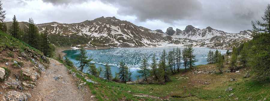
Lac d'Allos is a high mountain lake at an elevation of 2,248 m (7,375 ft) above sea level, located in the Alpes-de-Haute-Provence of France.
Where is Lac d'Allos?
This secluded alpine lake, nestled amid high and steep mountains, is located in the Provence-Alpes-Côte d'Azur region, in the southeastern part of the country, in the heart of the Mercantour National Park.
Why is Lac d'Allos famous?
It’s said to be the largest natural high-altitude lake in Europe. The lake water comes mainly from melting snow and autumn rains. Near the lake, there’s a mountain lodge called Refuge du lac d'Allos, and a little chapel known as Chapelle Notre-Dame des Monts du Lac d'Allos.
How long is the road to Lac d'Allos?
Starting from Allos on the D908 road, the road to the lake is 11.3 km (7.02 miles) long. The first 9.5 km are paved. At the end of the road, you will arrive at a parking lot called “parking du Laus”. Beyond this point, motor vehicles are banned. The last 1.8 km are gravel, but driveable by 4x4. The elevation gain is 830 meters. The average gradient is 7.34%, but it’s pretty steep, with some sections up to 16.0%.
When can I drive to Lac d'Allos?
Set high in the center of the French Maritime Alps, the road to the lake is closed from October to June (weather permitting). During the high season (the last two weekends of June, the first two weekends of September, and from early July to late August), access is regulated.