El Moixer: Driving the 27 Hairpins to the Summit of Roc del Comptador
Reaching an elevation of 1,441m (4,727ft) above sea level, El Moixer is a dominant mountain peak situated on the border between France and Spain. Also known as Roc del Comptador, it stands as the highest point of the Alt Empordà region and the Serra de l'Albera range, providing a challenging high-altitude ascent for off-road drivers.
| Road facts: El Moixer (Roc del Comptador) | |
|---|---|
| Location | Spain (Girona) - France (Pyrénées-Orientales) |
| Elevation | 1,441 m (4,727 ft) |
| Length | 13.0 km (8.0 miles) |
| Elevation Gain | 1,067 m |
| Avg Gradient | 8.20% |
| Hairpin Turns | 27 |
Where is El Moixer located?
The peak is positioned on the international boundary between the Alt Empordà (Catalonia, Spain) and the Pyrénées-Orientales (Occitania, France). It towers over the town of Maçanet de Cabrenys. While the northern French slopes are impassable for vehicles, the southern Spanish face features a technical service road constructed to maintain the vital communication towers and antennas at the summit.
How long is the road to El Moixer from Maçanet de Cabrenys?
Starting from the mountain village of Maçanet de Cabrenys, the drive to the summit spans 13.0 km (8.0 miles). Over this distance, the road climbs a massive 1,067 meters in vertical desnivell. This results in a sustained average gradient of 8.20%. The route is a relentless climb that features 27 sharp hairpin turns, making it one of the most technical and rewarding mountain tracks in the eastern Pyrenees.
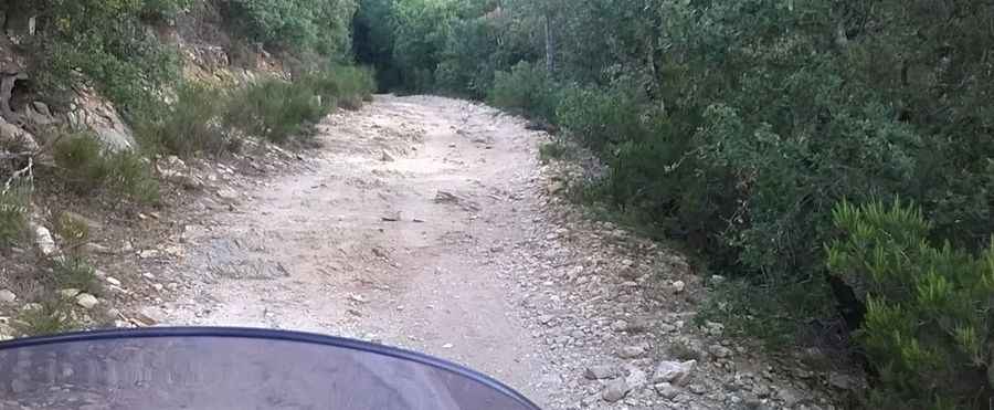
Is the road to Roc del Comptador unpaved?
The road surface is mostly gravel, consisting of loose rock and mountain soil that requires high-clearance 4WD. To ensure access for maintenance trucks during inclement weather, specific steep sections and the tightest hairpins have been reinforced with concrete slabs. The track is notably narrow, and in many places, passing another vehicle requires one driver to find a safe shoulder or reverse to a wider section of the ridge.
What are the main hazards on the 13km climb?
The primary hazards are the sustained steepness and the lack of safety barriers along the 27 hairpins. The high-altitude environment is frequently hit by the Tramuntana, a powerful north wind that can make vehicle handling difficult at the summit. During winter, snow and ice commonly block the road above 1,200 meters, making the concrete sections lethally slippery. Additionally, drivers should monitor their engine temperature during the long 1,067m ascent and check their brakes thoroughly before the 13 km descent back to Maçanet.
What is at the summit of El Moixer?
The summit is occupied by several large antennas and telecommunication towers. At 1,441 meters, the view is spectacular, stretching from the Cap de Creus and the Gulf of Roses on the Mediterranean coast to the impressive Massif du Canigó in France. The ridge acts as a perfect 360-degree lookout over the trans-border landscapes of the Albera range.
Pic: Peter Silberhorn