Driving the Piste du Capet to Pêne Det Pouri in the Pyrenees
Pêne Det Pouri is a high mountain peak at an elevation of 2,030m (6,660ft) above sea level, located in the department of Hautes-Pyrénées in France. Situated in the heart of the central Pyrenees, the summit offers one of the best balconies overlooking the famous Tourmalet area.
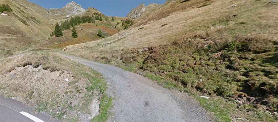
The road to the summit is known as the Piste du Capet. It is a rugged mountain track that climbs through high pastures, offering constant views of the surrounding peaks. Due to its location and altitude, the road is usually buried under snow and remains impassable from October to June. This is a high-alpine environment where the weather can change rapidly, and the narrow track with significant drop-offs requires full concentration.
| Road facts: Pêne Det Pouri (Piste du Capet) | |
|---|---|
| Location | Hautes-Pyrénées, France |
| Elevation | 2,030m (6,660ft) |
| Length | 5.9 km (3.66 miles) |
| Elevation Gain | 427 m |
| Hairpin Turns | 8 |
| Surface | Unpaved / Gravel |
How difficult is the road to Pêne Det Pouri?
The ascent is entirely unpaved and officially requires a 4x4 vehicle. Starting from the D918 road, just to the west of the legendary Col du Tourmalet, the climb is short but intense. Over a distance of 5.9 km (3.66 miles), you will face an elevation gain of 427 meters, featuring a trail that gets notably steep in several sections. The drive is famous for its 8 sharp hairpin turns that zigzag up the mountain flank, providing increasingly dramatic views of the Luz-Saint-Sauveur valley below.
Is the Piste du Capet worth the drive?
Absolutely, especially for those looking to escape the crowded paved passes of the Tour de France. The Piste du Capet leads you to a much quieter summit where the panoramic views of the Pic du Midi de Bigorre and the Ardiden massif are spectacular. However, the track is narrow and has sections with dangerous drop-offs that are not for the faint of heart. Experienced drivers will find it a rewarding detour while exploring the high peaks of the central Pyrenees.