Driving to Col de Platé: A brutal 13% 4x4 climb in the Haute-Savoie Alps
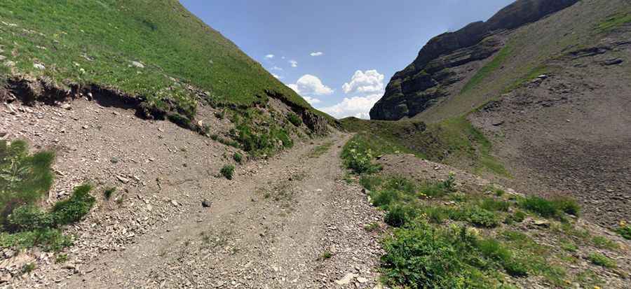
Located in the Haute-Savoie department of southeastern France, the track to Col de Platé is an extreme Alpine ascent. Reaching an elevation of 2,362m (7,749ft) above sea level in the Auvergne-Rhône-Alpes region, this is a raw service road used for ski resort maintenance.
| Road facts: Col de Platé | |
|---|---|
| Location | Haute-Savoie, France (Alps) |
| Elevation | 2,362 m (7,749 ft) |
| Length | 4.9 km (3.04 miles) |
| Elevation Gain | 675 m |
| Average Gradient | 13.77% |
How long is the road to Col de Platé?
The road to Col de Platé starts from the ski station of Flaine and covers 4.9 km of relentless climbing. With a vertical gain of 675 meters, the average gradient sits at a punishing 13.77%, with sustained sections that feel much steeper.
Is the road to Col de Platé unpaved?
The road surface is entirely unpaved, with loose gravel and jagged rocks. The track cuts through steep Alpine meadows where the ground is often unstable. Driving here requires a 4x4 vehicle with high clearance. The road is "tippy" and bumpy, with several hairpins.
What are the high-altitude hazards of the Platé mountain track?
Expect unpredictable mountain weather. Wet conditions turn this rocky path into a muddy trap. The track is completely impassable during the winter months, buried under several meters of snow. Even in summer, the risk of rockfalls from the surrounding limestone peaks is a real hazard that drivers must monitor constantly while driving the narrow shelf road.
Pic: thomas nicodeme