A drivable track to the summit of Col del Sommeiller
Col del Sommeiller is an international high mountain pass at an elevation of 2,993m (9,819ft) above sea level, located on the French-Italian border. It's one of the highest roads in Europe. This beautiful 26-kilometer climb above Bardonecchia has it all: hairpins, alpine dams, a lake at the summit, and views to die for.
Where is Col del Sommeiller?
Set high in the Alpi Cozie, this international pass is located on the border of France and Italy. It links the Savoie department of the Auvergne-Rhône-Alpes region in France and the Metropolitan City of Turin, in the Piedmont region of Italy. Located between Punta Sommeiller and Rognosa d'Etiache, at the summit is a stunning blue turquoise lake. On the hill was present Ambin Refuge, which was demolished in 2004.
Why is it called Col del Sommeiller?
The pass is named after Germain Sommellier, the chief engineer of the construction of the 13.7 km Fréjus railway tunnel under the Alps (opened in 1871) which starts exactly at the beginning of this climb.
Can you drive to Col del Sommeiller?
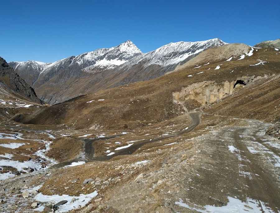
It’s possible to drive through the summit only from Italy. Starting at Bardonecchia, the road to the summit is 25.2km (15.65 miles) long. In France, there’s not any road to the summit. The road was opened in 1962 and in the following years were the lifts open for skiing on the glacier Sommeiller. These projects were closed in 1980 due to the backlog of the glacier and the practicability of the road is always difficult.
Is the road to Col del Sommeiller paved?
It's one of the highest roads of the country. The higher you get the runway becomes worse but it stays continuously drivable. Only the first 6 kms are paved (badly), and the surface for the remaining 20 kms can be rocky and challenging. The asphalted part of the Colle del Sommeiller, just a 20% of the route, runs until Rochemolles. The next "sterrato" (not asphalted) part (80%) is not too bad before reaching the Rifugio Scarfiotti. Next however, it turns out rather unconnected in the conclusive part.
Is Col del Sommeiller challenging?
The road is pretty defiant. A 4x4 vehicle is required. The road features a full collection of switchbacks alternating with straight but steep parts. Starting from Bardonecchia, the ascent is 26.3 km long. Over this distance, the gain is 1,711 meters. The average percentage is 6.5%, and the maximum is around 19%.
Is Col del Sommeiller open?
This road is seasonally closed and usually impassable from late October through late June or early July (depending on snow). It gets cleared from the snow only in late July. Since 2007, the city of Bardonecchia decided to partially close the road to traffic from the Colle del Re Scarfiotti Sommeiller on Thursdays from 01 July to 30 September.
Pic: Marc Aguado i Jordana.