Pas des Chapelets: Driving the high service road in Courchevel
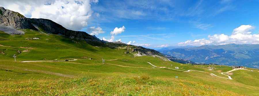
Located in the heart of the Tarentaise Valley in the Savoie department of France, Pas des Chapelets is a high mountain peak reaching an elevation of 2,243m (7,358ft) above sea level. This high-altitude point sits on a dramatic ridge within the Vanoise National Park, offering some of the most expansive views in the Auvergne-Rhône-Alpes region.
| Road facts: Pas des Chapelets | |
|---|---|
| Location | Savoie, France |
| Elevation | 2,243 m (7,358 ft) |
| Length | 8.0 km (4.9 miles) |
| Surface | Paved / Gravel |
| Max Gradient | High (Service Road) |
How to reach Pas des Chapelets from Courchevel?
The journey to the summit starts in the world-famous resort of Courchevel. The road spans 8.0 km (4.9 miles) and is characterized by its technical and winding nature, featuring 15 sharp hairpin turns that climb rapidly up the mountainside. The initial section of the climb is paved, as it services the lower resort infrastructure, but as you gain altitude and approach the ski station's higher sectors, the surface transitions into a rugged gravel track.
Is the road to Pas des Chapelets open to the public?
This route is primarily a service road for the ski lift infrastructure and mountain maintenance. While it provides access to the high ridges during the summer months, the road is impassable and closed during the winter, as it becomes part of the active ski slopes of the "Les Trois Vallées" domain. For those driving in the summer, a vehicle with reasonable ground clearance is recommended for the final gravel stretches, as the track can be steep and uneven.
What are the views like at Pas des Chapelets?
Reaching the Pas des Chapelets reward drivers with a panoramic view over the Vanoise National Park. From this vantage point, you can survey the vast alpine meadows and the jagged peaks of the Savoie region. The ridge marks a geographical boundary, and the environment is strictly protected; visitors are encouraged to stay on the designated tracks to preserve the fragile high-altitude flora. Due to the elevation, the air is noticeably thinner, and weather conditions can change in minutes, even on clear summer days.
What hazards should I expect on the Courchevel service roads?
The main hazards include steep gradients and narrow sections where passing other vehicles—often heavy maintenance trucks—can be difficult. The 15 hairpins require constant attention, and the unpaved sections may have loose stones that reduce traction. Additionally, the road is shared with mountain bikers and hikers during the peak summer season. Always check your brakes before the 8 km descent back to Courchevel, as the constant steepness can quickly lead to brake overheating.
Pic: Richard Vacheron