Road to Refuge de Moëde Anterne: Driving the 8.85% Track in the Fiz Mountains
Located in the Fiz mountains of the Haute-Savoie department in south-eastern France, Refuge de Moëde Anterne is a high-altitude mountain hut at an elevation of 1,984m (6,509ft) above sea level. Situated within the Réserve Naturelle de Passy, the road to the refuge is a technical mountain track used primarily for logistics, supply transport, and mountain rescue operations.
| Road facts: Refuge de Moëde Anterne | |
|---|---|
| Location | Passy, Haute-Savoie, France |
| Elevation Gain | 673 m |
| Length | 7.6 km (4.72 miles) |
| Average Gradient | 8.85% |
| Surface | Unpaved / Loose Scree |
How is the road to Refuge de Moëde Anterne?
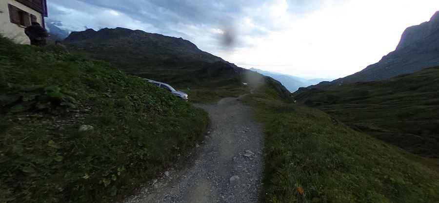
The ascent to the refuge starts from the Parking de Plaine-Joux. The road is 7.6 km (4.72 miles) long and is entirely unpaved. Over this distance, the track gains 673 meters of elevation, resulting in a sustained average gradient of 8.85%. The surface consists of loose limestone scree and rocky steps. Motorized access is strictly regulated due to the environmental protection of the Passy Nature Reserve, requiring specific authorization for service vehicles and 4x4 supply units. The track features high-exposure sections as it climbs toward the Col d'Anterne plateau.
What are the driving hazards in the Fiz mountains?
The primary hazards on the track to Moëde Anterne are the steep gradients and unstable terrain. The 8.85% average slope includes internal ramps exceeding 12%, where maintaining traction on loose rocks is critical. The track is narrow, with vertical drops and no safety barriers. During the summer, the route is heavily populated by hikers, requiring low speeds and constant vigilance. Heavy rain can cause rapid erosion, creating deep ruts that can high-center vehicles without sufficient ground clearance. Historically, this technical track was used as a logistics corridor for French Resistance fighters during WW2, emphasizing its strategic and difficult nature.
Is the road to Moëde Anterne open year-round?
The road is impassable for the majority of the year due to heavy snow accumulation in the Savoie region. Access is typically restricted to the summer months, from late June to September. Even in summer, sudden alpine storms can reduce visibility and traction in minutes. There are no mechanical or refueling services available beyond Plaine-Joux. Authorized drivers must be self-sufficient and ensure the vehicle's cooling system is in peak condition to manage the thermal stress of the 673m vertical climb.
What is the driving strategy for the 8.85% gradient?
Navigating the 7.6 km climb requires the use of low-range gearing to maintain constant torque on the loose upper sections. On the descent back to Passy, engine braking is mandatory to prevent brake fade on the sustained 8.85% slope. It is necessary to monitor tire pressure to maximize the contact patch on the gravel ramps. Due to the historical and environmental sensitivity of the site, authorized motorized transit must be conducted with minimal environmental impact, avoiding wheel spin on the fragile alpine soil near the refuge.
Pic: Pascal Corpet