How to get by car to Mont Faron in Toulon?
Mont Faron is a mountain peak at an elevation of 584 m (1,916 ft) above sea level, located on southern France’s Mediterranean coast, overlooking the city and roadstead of Toulon. It features sweeping views and a WWII memorial.
Where is Mont Faron?
The peak, the most dominating landmark of Toulon, is located in the Provence-Alpes-Côte d'Azur region, in the southern part of the country. At its peak is a memorial dedicated to the 1944 Allied landings in Provence (Operation Dragoon) and to the liberation of Toulon.
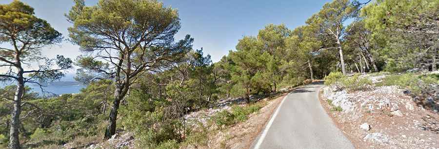
Is the road to Mont Faron paved?
The road to the summit is one of Europe's Greatest Cycle Climbs. It is known as Chemin du Fort Rouge, Chemin de la Baume, and Route du Faron. It’s a very narrow one-way road, and the asphalt is a bit rough. The tarmac is a little broken in places. This steep and narrow road ascends from the west side and descends on the east side.
How long is the road to Mont Faron?
The climb is pretty steep, with some sections up to 11.4%. Starting from Toulon, the ascent is 5.5 km (3.41 miles) long. Over this distance, the elevation gain is 494 meters. The average percentage is 9%. The road is one of the most challenging stages of the annual Paris–Nice and Tour Méditerranéen bicycle races.
Is Mont Faron worth the drive?
This panoramic road offers magnificent sea views. The summit offers really fantastic views over the naval port of Toulon. All along the way, there are stupendous views across the bay, one of the most beautiful in Europe. From the top of the mountain, the view of France’s forgotten city and massive military harbour is merely splendid. In the early morning and at sunset, the azure Mediterranean waters and verdant coastline look especially stunning.