The wild unpaved road to Col de la Fréte in Savoie
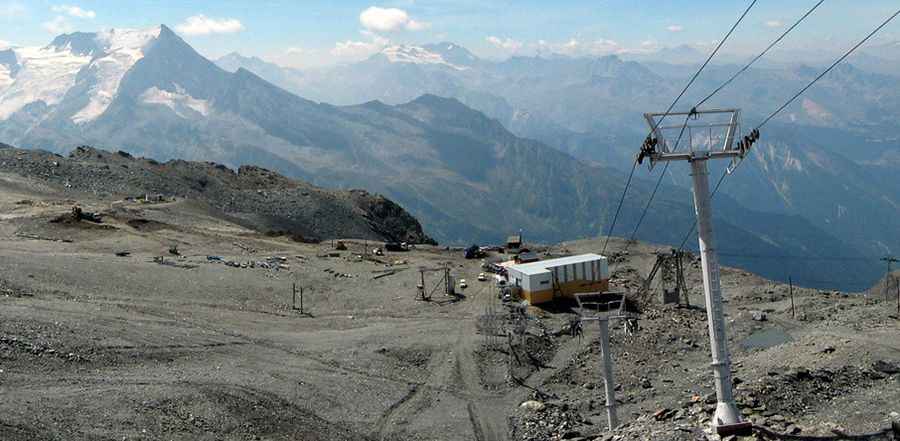
Col de la Fréte is a high mountain pass at an elevation of 2.494m (8,182ft) above sea level, located in the Savoie department in France.
Where is Col de la Fréte?
The pass, also known as Col de la Chiaupe, is located in the Auvergne-Rhône-Alpes region, in the south-eastern part of the country, in the northern part of the Vanoise National Park.
Is the road to Col de la Fréte unpaved?
The road to the summit is totally unpaved, with many turns. It’s a chairlift access trail very steep. A 4x4 vehicle is required. It’s closed to private vehicles.
How long is the road to Col de la Fréte?
Starting from Plagne Bellecôte, the road to the summit is 7 km long.
Is the road to Col de la Fréte open year-round?
Set high in the Vanoise Massif of the Graian Alps, the road is usually impassable from October through June.
Pic: https://www.remontees-mecaniques.net/forums/index.php?showtopic=24297