The Road to Col de Chaviere is Not for the Faint of Heart
Col de Chavière is a high mountain peak at an elevation of 2,477m (8,126ft) above sea level, located in the Savoie department of France.
Where is Col de Chavière?
The peak is located in the Auvergne-Rhône-Alpes region, in the south-eastern part of the country, in the heart of the Vanoise National Park.
What’s at the summit of Col de Chavière?
At the summit, there’s a mountain refuge called Refuge de Peclet Polset, located close to Lac Blanc, a lake fed by a glacier that has a milky white color.
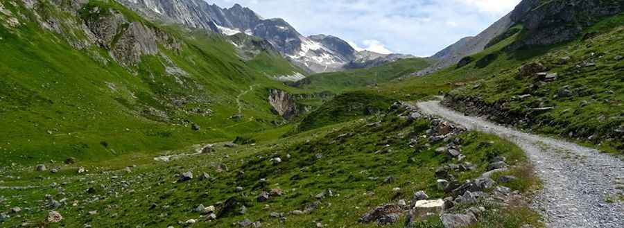
Is the road to Col de Chavière unpaved?
The road to the summit is totally unpaved. It’s very narrow, with many big rocks. It is closed to private vehicles.
How long is the road to Col de Chavière?
Starting on a parking lot at the end of the paved D124 road, the ascent is 7.4 km (4.59 miles) long. Over this distance, the elevation gain is 703 meters. The average gradient is 9.5%.
Is the road to Col de Chavière open in winter?
Set high in the Massif de la Vanoise range, the road is usually impassable from October to June.
Pic: bodha jac