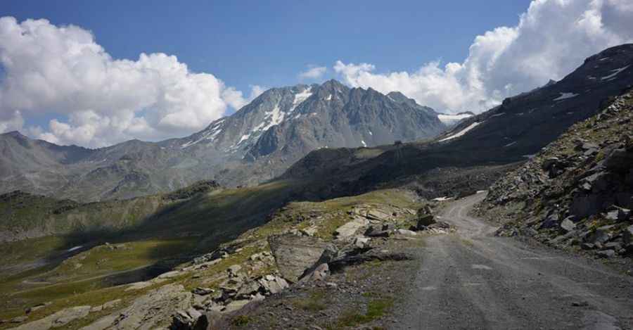
Aiguille de Peclet is one of the highest roads of Europe
Aiguille de Péclet is a high mountain peak at an elevation of 2,951m (9,681ft) above sea level, located in the Savoie department of France. It’s one of the highest roads in Europe.
Where is Aiguille de Péclet?
The peak is situated at the foot of the Péclet Glacier, in the Auvergne-Rhône-Alpes region in the southeastern part of France. At the summit, there’s a restaurant called Les Aiguilles de Péclet.
Is the Road to Aiguille de Péclet Unpaved?
Located within the Vanoise National Park, the road to the summit is entirely unpaved and accessible via chairlift. A 4x4 vehicle is required, and the road is closed to private vehicles.
Is the Road to Aiguille de Péclet Open in Winter?
Set high in the Massif de la Vanoise of the French Alps, the road is completely impassable from October through June due to heavy snow.
How Long is the Road to Aiguille de Péclet?
The road to the summit is 10.3 km (6.4 miles) long, starting from the D117 road. Over this distance, the elevation gain is 702 meters, with an average gradient of 6.81%. It's one of the highest roads in the country.
Pic: https://www.altituderando.com/Cime-de-Caron-3195m-par-Val