Road to Col du Palet: Driving the 13.06% Service Track in Savoie
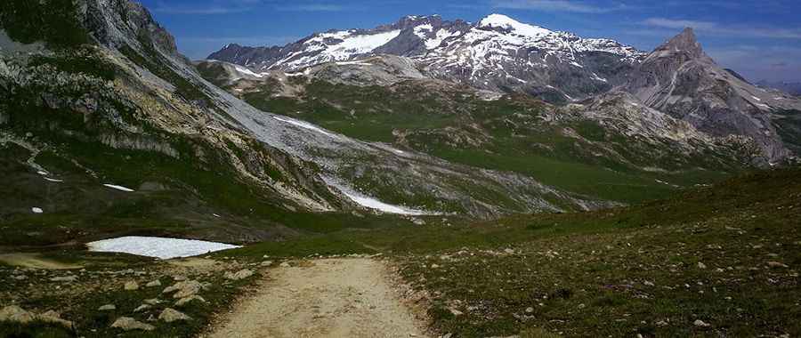
Reaching an elevation of 2,658m (8,720ft) above sea level, Col du Palet is a high mountain pass located in the Savoie department, within the Auvergne-Rhône-Alpes region of southeastern France. Situated in the heart of the Vanoise National Park, the route is one of the highest roads in the country.
| Road facts: Col du Palet | |
|---|---|
| Location | Savoie, France (Vanoise National Park) |
| Elevation Gain | 562 m |
| Length | 4.3 km (2.67 miles) |
| Average Gradient | 13.06% |
| Surface | Unpaved / Alpine Piste |
How is the road to Col du Palet?
The ascent to Col du Palet begins in Tignes, starting from the ski resort's perimeter. The track is 4.3 km long and is entirely unpaved. Over this short distance, the road climbs 562 meters, resulting in a sustained average gradient of 13.06%. The surface consists of loose Alpine scree and compacted soil, which is subject to constant erosion. Beyond the main pass, a minor unpaved spur climbs further to an elevation of 2,677m (8,782ft) to reach a chairlift terminal. Due to the extreme gradients and high-altitude terrain, 4x4 capability and low-range gearing are essential for operational transit.
Is the road to Col du Palet open to private vehicles?
The road to Col du Palet is strictly closed to private motorized vehicles. Located within the Vanoise National Park, French environmental regulations (Code de l'Environnement) prohibit off-road driving and unauthorized transit on mountain tracks. Access is exclusively reserved for National Park rangers, emergency services, and maintenance crews serving the Refuge du Col du Palet and the local ski infrastructure. Any unauthorized attempt to drive this route is subject to heavy fines and legal sanctions. Pedestrians and mountain bikers are the primary users of this corridor during the summer months.
What are the driving hazards on the Col du Palet service track?
For authorized personnel, the primary hazards on the road to Col du Palet include severe oxygen starvation for engines and extreme slope exposure. The 13.06% average gradient puts immense pressure on the vehicle's cooling and transmission systems. On the descent, reliance on standard braking is hazardous; engine braking is mandatory to prevent thermal failure on the steep ramps toward Tignes. The proximity to Lac du Grattaleu and the refuge means that the track often has high pedestrian density, requiring defensive driving and low speeds at all times.
How does weather affect the road to Col du Palet?
Due to its high altitude, the track is impassable from October to June, as it remains under several meters of snow for most of the year. Snowmelt in early summer often leaves the ground saturated and unstable, making the 13.06% slopes prone to landslides or localized washouts. Rapid convective thunderstorms are a constant risk in Savoie, capable of turning the dry Alpine piste into a slippery mud slurry in minutes. Drivers must monitor sky conditions, as the 2,658m summit offers no protection against lightning or high-velocity wind gusts common in the Vanoise massif.
Pic: gurvan le nir