The unpaved road to Col de la Bathie in Savoie
Col de la Bâthie is a high mountain pass at an elevation of 1,884m (6,181ft) above sea level, located in the Savoie department of France.
Where is Col de la Bâthie?
The pass is located south of Mont Mirantin, in the Auvergne-Rhône-Alpes region, in the south-eastern part of the country.
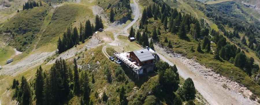
What’s at the summit of Col de la Bâthie?
At the summit, there’s a mountain hut called Refuge Les Arolles, built in 1987. It provides great views of Arêches, but especially Mont Blanc. There is also a cross at this pass.
How long is the road to Col de la Bâthie?
The road to the summit is totally unpaved, and comprises very narrow parts and steep sections. It’s called Route Forestière de la Ravoire. It’s about 6km (3.7 miles) long, starting from Le Mondon.
Is Col de la Bâthie open in winter?
Set high in the Beaufortain Massif, the road tops out at 2,024m (6,640ft) above sea level. It’s not maintained in winter.
Pic: David Bertin