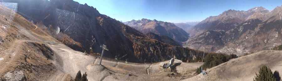
Driving the steep 13% track to the summit of La Norma
La Norma is a high mountain peak at an elevation of 2,584m (8,477ft) above sea level, located in the Savoie department in France.
Where is La Norma?
The peak is located in the Auvergne-Rhône-Alpes region, in the southeastern part of the country, in the heart of the Vanoise National Park. The 360-degree views of the Savoie peaks from the summit are the ultimate reward.
| Road facts: La Norma | |
|---|---|
| Location | Savoie, Auvergne-Rhône-Alpes (France) |
| Elevation | 2,584 m (8,477 ft) |
| Length | 8.9 km (5.5 miles) |
| Average Gradient | 13.47% |
| Hairpin Turns | 14 |
| Surface | Unpaved / Loose gravel |
Is the road to La Norma unpaved?
The road to the summit is totally unpaved. It’s said to be one of the most punishing unpaved climbs in the French Alps. It’s a track used for chairlift maintenance. The track features 14 sharp hairpin turns. In many sections, you are driving on a ledge with drops of hundreds of meters on one side and no guardrails to stop you. This isn't a road for anyone who gets nervous with heights or steep, unprotected drops.
How long is the road to La Norma?
Starting from Ski Club La Norma, the road to the summit is 8.9 km (5.5 miles) long. Over this distance, the elevation gain is 1,199m and the average gradient is 13.47%. A 4WD vehicle with high clearance and low-range gears is required.
Is the road to La Norma open year-round?
The area features unpredictable snowstorms and blizzards that can hit even in the middle of summer. Because it sits at such a high elevation, snow and ice keep the road blocked for most of the year, usually making it completely impassable from November until at least June. If the ground is wet, the loose dirt turns into a nightmare.
Pic: http://www.skieur.com/station-ski-webcam-la-norma