How to drive the military track to Col de la Roue?
Col de la Roue (also known as Colle della Rho) is a high-altitude mountain pass at an elevation of 2,534 m (8,313 ft) above sea level, situated on the border between France (Savoie) and Italy (Piedmont). Logistically, the pass follows an ancient military corridor between the Maurienne and Susa valleys. Technically, the route consists of a degraded military track that presents significant challenges for high-altitude navigation and vehicle mechanical stress.
| Road facts: Col de la Roue | |
|---|---|
| Location | French-Italian Border (Alps) |
| Elevation | 2,534 m (8,313 ft) |
| Length | 7.8 km (from Valfréjus) |
| Average Gradient | 12.25% |
What is the technical difficulty of the road to Col de la Roue?
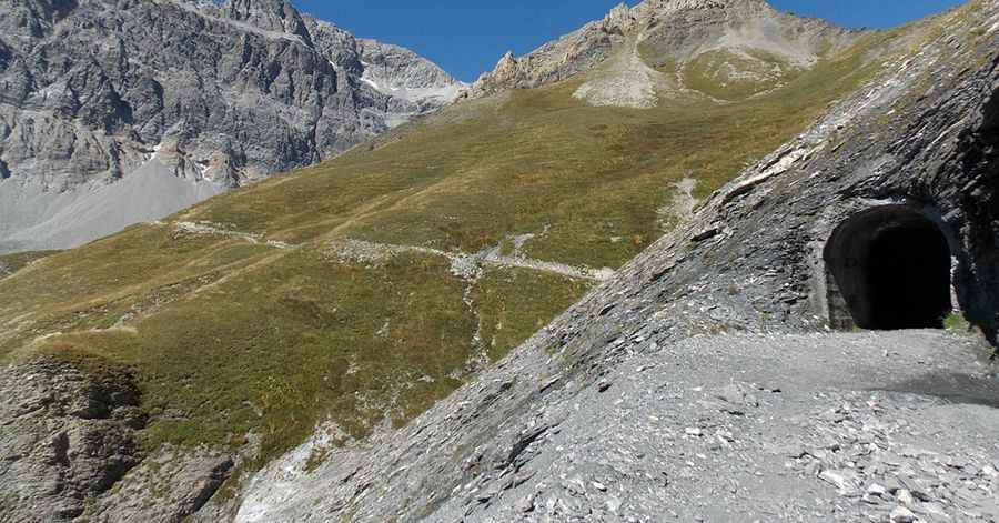
Starting from the Valfréjus ski lifts, the ascent to the summit covers 7.8 km with a vertical gain of 956 meters. Technically, this results in a sustained average gradient of 12.25%, with specific ramps exceeding 15%. The surface is entirely unpaved, consisting of loose gravel and schist. Logistically, the track is narrow and features tight hairpin turns that were originally engineered for light military transport. Due to the lack of modern maintenance, several sections are partially washed out, requiring high ground clearance and precise tire placement to avoid chassis damage on the bumpy substrate.
What are the access restrictions and logistics for Col de la Roue?
Technically, the road to Col de la Roue is an old military track that is currently closed to unauthorized motorized vehicles in several sectors. Logistically, it remains a critical route for specialized maintenance and border patrol. For those operating authorized vehicles, the route is impassable from September to June due to heavy snow accumulation and the risk of avalanches from the surrounding peaks. Safety protocols mandate a thorough check of the braking system, as the 12.25% descent toward the Modane area creates extreme thermal loads on the pads and rotors, necessitating the constant use of low-range engine braking.
How does the Alpine terrain affect transit at 2,534m?
At an elevation of 2,534m, the logistics of the Colle della Rho are dictated by high-altitude weather patterns. Technically, the track's exposure to the elements means that summer thunderstorms can quickly turn the loose gravel into a slippery slurry, compromising traction. Logistically, there are no support points or refueling stations along the 7.8 km climb. Drivers must account for the mechanical strain of operating at high torque on steep, uneven terrain. The view from the summit provides a logistical overlook of the Fréjus Rail Tunnel area, but focus must remain on the technical descent, where the combination of loose rocks and vertical drop-offs leaves no margin for steering errors.
Pic: Slide78 https://it.wikiloc.com/percorsi-mountain-bike/passo-della-rho-colle-frejus-7822237/photo-4503353