How to drive the unpaved road to Col de Chérine
Col de Chérine is a high mountain pass at an elevation of 2,295m (7,529ft) above sea level, located in the Hautes-Alpes department of France.
Where is Col de Chérine?
The pass is located in the Provence-Alpes-Côte d'Azur region, in the southeastern part of France. During winter, the road to the summit becomes impassable.
Is Col de Chérine unpaved?
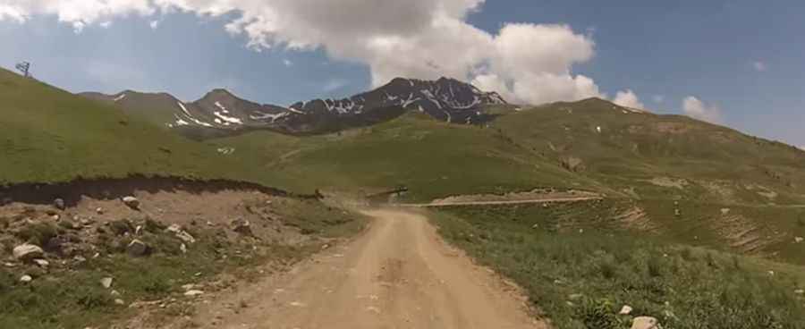
The road to the summit is completely unpaved and bumpy, with some patched spots. 4x4 vehicles only. The drive offers breathtaking views of the Queyras, the Embrunais, and the Pelvoux Massif.
How challenging is the road to Col de Chérine?
Steep, narrow, and full of hairpins, the route is partly washed out and rough. The trail is mainly used to provide access for ski lift and lodge maintenance. It is exposed to strong winds and features very steep sections, reaching a maximum gradient of 10.5% in some ramps.
How long is the road to Col de Chérine?
Starting from Vars, the road to the summit is 13.9 km (8.63 miles) long. Along the way, the road climbs up through several passes, including Clot de l’Alpe, Col de Valbelle, Col du Vallon and Col de Saluces.
Pic: forgumpone