Mont Bouquet
Mont Bouquet is a mountain pass at an elevation of 628m (2,060ft) above the sea level, located in the Gard department in southern France.
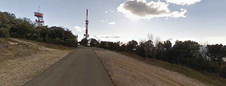
The road to the summit is asphalted but in very bad conditions. It’s called D607A and includes very steep sections, up to 19.0%. The pass is a vast limestone promontory in the chaparral countryside of the Gard, between the towns of Alès and Bagnols-sur-Cèze. At the peak there is a chapel with a statue of the Virgin, and a high, 60-meter TDF antenna called the “guidon du Bouquet" and culminating at 631 meters. In addition to the television relay there is a fire tower which is very effective in periods of drought.
There are 2 routes to reach the summit. Starting from Brouzet les Ales, the ascent is 4.6 km long. Over this distance, the elevation gain is 437 meters. The average percentage is 9.5 %. And starting from Seynes, the ascent is 5.49 km long. Over this distance, the elevation gain is 341 meters. The average percentage is 6.2 %.