How to drive the steep road to Mont Tauch?
Mont Tauch is a mountain peak at an elevation of 871m (2,857ft) above sea level, located in the Aude department in southern France.
| Road facts: Mont Tauch | |
|---|---|
| Location | Aude, Occitania, France |
| Length | 5.3 km (3.2 miles) |
| Max Gradient | 22% |
| Average Gradient | 12.79% |
| Hazard Level | High (Extreme gradients, loose gravel, strong wind) |
Where is Mont Tauch located?
The peak is located near the Tour des Géographes at 879 meters, in the Hautes Corbières region of southern France.
Why is it called Mont Tauch?
The word "Tauch" derives from the pre-Indo-European root *tuc/tous/tos/tau*, meaning head or a summit with a round and massive appearance.
Why is there a road to Mont Tauch?
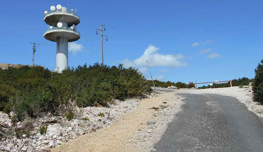
At the summit, there is a communication tower and a wind farm. The original tower on this peak was built in 1791 to accurately measure the meridian arc from Dunkirk to Barcelona.
Is the road to Mont Tauch paved?
The road to the summit is fully paved, but narrow and extremely steep. In recent years, the tarmac surface has deteriorated significantly, leaving potholes, loose stones, and gravel scattered across the lane. Driving up requires full attention, as maximum gradients reach 20-22% on several ramps. Strong winds coming off the coast often hit the exposed upper ramps hard, making control difficult.
How long is the road to Mont Tauch?
Starting from the D39 road junction, the climb to the summit is 5.3 km long. Over this stretch, the road climbs 678 meters of vertical gain with a relentless average gradient of 12.79%.
Pic&more info: http://velo-vtt-claude.blogspot.com.es/2017/09/le-mont-tauch-ascension-la-plus-dure.html