Ultimate 4WD Destination: Col des Lessieres in the Alps
Col des Lessières is a high mountain peak at an elevation of 2,936m (9,632ft) above sea level, located in the Savoie department of the Auvergne-Rhône-Alpes region of France. It's one of the highest roads in Europe.
Where is Col des Lessieres?
The peak is located near the Italian border, within the Tarentaise Valley, in the southeastern part of France.
Is the road to Col des Lessieres challenging?
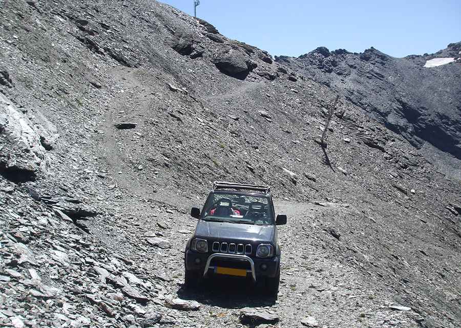
The road to the summit is entirely unpaved, featuring significant rocks and loose gravel. It's a chairlift service road leading to Lessières Tunnel, accessible only to 4x4 vehicles. The track includes several narrow sections, numerous hairpin turns, and steep parts (up to 25%). It’s one of the highest roads in the country.
How long is the road to Col des Lessieres?
Starting from the paved D902 road, the ascent is 4.2 km (2.60 miles) long. Over this distance, the elevation gain is 458 m, with an average gradient of 10.90%.
Is the road to Col des Lessieres open in winter?
Set high in the French Alps, due to its elevation, the road is impassable from October to June.
Pic: Bram van Gelder